Quick Pics Between Trips

Editing photos right after a trip has always been a challenge for me. I find it hard to judge whether my photos are good or not because I’m usually judging my memory of the place rather than the photo. After a few months I find I can be more objective. But a few months is a long time to wait for photos. Sometimes whole trips get forgotten.

So here’s me trying to do quick edits. I still gave myself a few days, but I wanted to get these up before I leave on my next trip (actually in a few hours) and this last one is forgotten. These are from just east of Jasper National Park.

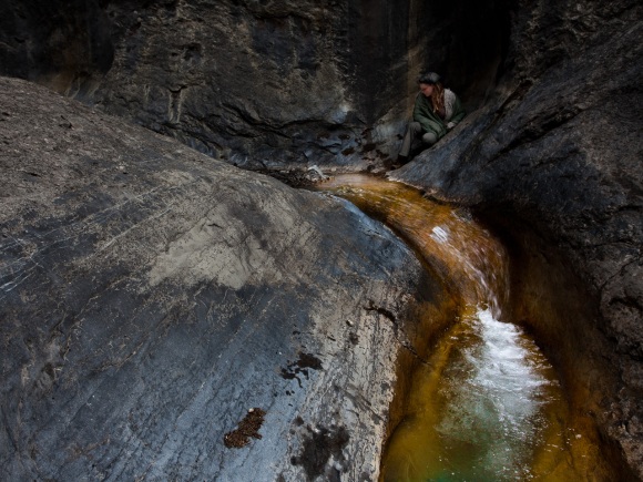
Anna in Ogre Canyon near Brule

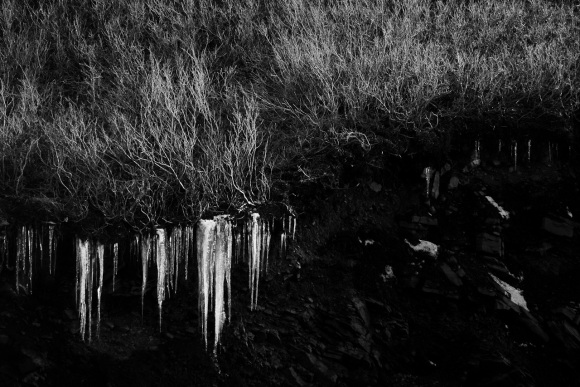
Icicles hanging from a cutaway

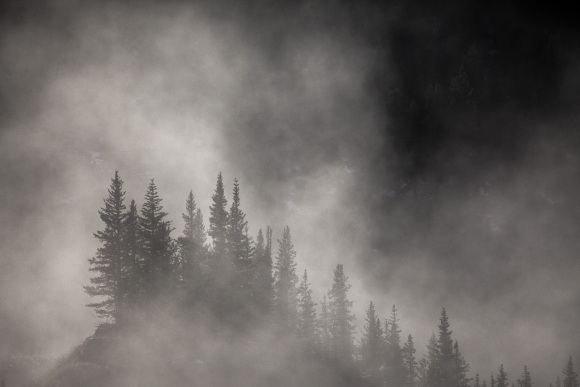
Spruce trees near Cadomin

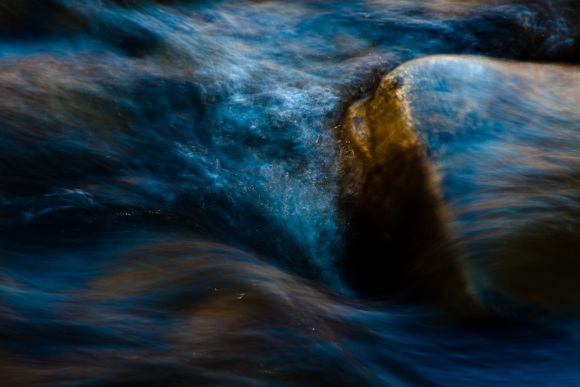
Evening light on the river

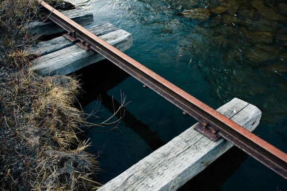
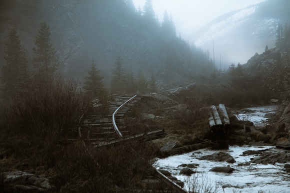
An old abandoned railway

Adventures / Misadventures

I get up at 5 in the morning, pull out a couple granola bars for breakfast, and organize my daypack for the hike. Sunrise is at 6:11 but at 6 it’s still pretty dark because of the clouds. It looks like it will be an overcast day – not so good for pictures, but at least it won’t be too hot. I drive for a couple minutes to reach the trailhead, lock up the car, and start the hike. Right away I’m climbing, first through poplar, then mixed, and finally alpine spruce forest. It is a very long and grueling climb before any meadows appear – I’m all about the meadows. The first meadow is the valley between Mt. Stearn and ridge I’m heading for. Mt. Stearn is the shorter and easier hike, so of course I’ll be taking the right branch to the ridge. Right away, I’m climbing through more trees, which is a bit of a disappointment. The trail continues to climb, alternating between thick trees and small meadows. I cross rocky creeks, muddy streams, and everything in between. None of my maps have the trail on them, so I assume I’ll be heading up the first slope to the ridge. Nope. The trail follows the ridge all the way to the far end, and then climbs that slope. Finally I leave all the trees behind me! Meadows, scree and amazing views await! (until I get into the cloud of course – the clouds are covering the very top of the ridge) I arrive at a beautiful little lake, surrounded on one side by the mountain, and the other by open meadows.

Then I hear it – rumbling. Is that thunder or a rockslide? It can’t be thunder, these are overcast clouds, not thunder clouds. KABOOM! The flash and sound instantly flatten me. Was that instinct or did the sound knock me over? The lightning hit a couple hundred yards away. I’m currently the highest object in the meadow. KABOOM! Another one. Now it’s starting to rain, and at 7000 feet it’s cold. There is no kind of cover for a long way. So I start to crawl on my hands and knees through a freezing marshy meadow. My hands are white with cold, my pants are totally soaked. At least I have my rain jacket and a couple layers underneath. Lightning is still flashing all around, and the thunder is shaking me. Or is that fear? Or cold? Finally I reach a gully, so I feel fairly safe walking again. Now it starts hailing – pea size now – hopefully it doesn’t get bigger. The gully is getting slippery and slushy with melting hailstones. My mind races ahead to all the places where the trail is exposed. Can I avoid them? Now I’m thankful that there aren’t too many meadows. The storm doesn’t seem to be letting up. I end up making some detours through spruce thickets, thoroughly soaking myself. My brain finally realizes that lightning isn’t the only problem here. I’m really cold. I’ve heard that staying dry is the best way to avoid hypothermia. So much for that. There’s nothing I could start a fire with here either – everything is far too wet. I decide that the best thing is to just keep moving and get down off the mountain as quickly as possible. It’s about 5 hours back to the car, I should be able to do that. I grab some trailmix and speed up, letting my body create its own heat. Eventually the hail stops, and the rain slows a little. The lightning is getting less frequent. I continue to hurry down, and as I do the air starts to get a little warmer. Now I’m just thinking of getting into the car and turning up the heater full blast.

I get to the car and unpack everything – peel apart papers from my wallet (silly me – I forgot to put it in a ziploc bag), dump out my camera bag (there was half an inch of water in the bottom), and wring out my socks. And I shakily write down a few notes about my hike. Oh yeah, the ridge I was heading to? – Lightning Ridge.

Some notes:
– Lightning is often avoidable, it’s not smart to hike in storms – but the forecast was for 30% chance of rain
– Lightning only kills about 20% of the time – but it causes various levels of disabilities over 70% of the time, and alone on a mountain that would often kill.

June Crowsnest Pass Trip

In my last post I wrote about Kananaskis Country. From K-Country I drove down the forestry road to Crowsnest Pass. This is a fairly well maintained gravel road, but it was dusty. It was late in the evening, and I wanted to find a place to camp. They say when criminals are on the run, they go somewhere familiar. I’m not aware of any criminal activities I was involved in, but I did the same thing. The trailhead for the Promised Land hike is out of the way, so I drove out there (my poor car) and slept in the car. Now I may just have a little old Honda Accord, but I had a pretty sweet setup with the back seat folded down, my feet in the trunk and my head up by the driver’s seat. My thermarest provided a nice bed, and the fact that it’s an old car means that it had good ventilation without letting in mosquitoes. As far as I know, no one drove by the whole night, and I even slept in till 6:30 or so. The trees shaded my car so the sun didn’t wake me up for a while.

I didn’t have any plans, but I was almost out of water, so I drove down to the Frank Slide. If you turn south just on the west side of the Slide, there is a little gravel road that starts in Frank, goes through the slide, and comes out near Hillcrest. I took this little road and stopped at one of wider areas in the slide. After a little bit of rock-hopping, I got down to the Crowsnest River and sat on a big rock, letting the sun warm my back as it rose, and watching the river flow. The swallows were swooping around, there were some ducks puttering on the slow swampy parts, and then a couple deer came out to join me. They wandered around eating and drinking in the river for a bit, then I stood up to get a better look and they went bounding off. After relaxing a while and filling up my water bottles, I still hadn’t decided what to do with the day. I drove off to the tourist info booth to ask about hikes, and they showed me this brochure with a bunch of hikes on it that I couldn’t have. Grr. But they told me I might be able to get one at the Crowsnest Museum in Coleman. I found one at the museum, and decided to go see the falls on the York Creek.

I have hiked up to the plane crash (the North York Creek hike), but had never seen the falls on the same river. It turns out that the upper falls are a few feet away from the road on the other side of York Creek. The lower falls are also just a short walk, although you can’t get very close to these.

After getting back to the car, I drove out to Chinook Lake, which is a provincial camp ground (along with lake and trail). It looks like it would be a pretty nice place to camp – the sites are somewhat secluded in a thick forest of tall thin pines. It is the standard $14 per night of all (I think) provincial campgrounds. I drove down to the lake, had lunch and read for a while. In the afternoon I did the short easy walk around the lake, which is pretty nice, but nothing spectacular. There is a whole network of trails that go all over the place here. The trails are mostly flat, and not especially exciting, although many of them are groomed for cross-country skiing in the winter.

More coming in bit…

K-Country and Crowsnest Pass

It’s been a week since I travelled down south to Kananaskis and Crowsnest Pass, and high time I write something here. I’ve never been through Kananaskis Country before, so I thought it would be interesting to drive through, and possibly do some hikes. I bought a guide book called “Popular Day Hikes”, which was pretty informative, and did a couple hikes in there. Being the crazy person I am, I left at around 9 in the evening and drove till 2 or 3 in the morning, and slept in the car in a visitor information parking lot in K-Country that had a sign saying it was closed between 11pm and 7am. So I got up at 5 and kept going.

Mornings outdoors are amazing. This is when all the animals are out, the light is beautiful, and everything feels fresh. That and almost no one else is around. So I made a few quick stops at Barrier Lake and Mt Lorette Ponds before starting my first real hike of the trip.

This was the middle of June, so the first hike I wanted to do, Centennial Ridge of Mt. Allan, was closed until the end of June so hikers wouldn’t disturb the young animals (such as goats and sheep), which are still at lower elevations. So I kept going down highway 40, stopping here and there to check out any roadside turnouts. I finally got down to Highwood Pass, which apparently is the highest paved pass in Canada. I parked in the parking lot there and started hiking up to Ptarmigan Cirque. The trail was mostly covered in snow, but the day turned out to be sunny and warm. It is a short, pretty steep hike up to the cirque, and then a pleasant walk around up there. A little stream flows through it, cascading over rocky outcrops (and under snow patches at this point). On the way down some (are they called a flock if they’re bighorns?) bighorn sheep ran up the slope past me.

I kept driving south, and stopped at the Mist Creek turnout to do the Mist Ridge hike. This trail is also used by horses, so it was wide and muddy in places. The first few kilometers were a little boring, through marshes and trees. A while after the trail forks, the trees start to open up a bit and there are some pretty nice views (which are great excuses to take a break). Then you go way down to cross a stream and curse the trail because you know you’re going to have to climb all that way back up again and more. But it’s not too bad, and the switchbacks across flowery and grassy slopes are very nice. Eventually the trail fades out, and you just climb the hill (and climb, and climb) and eventually you get to the top of the ridge. Well, not really the top, because the point you can see off to the north is the south peak. But by this point, the walking is easy, the mountains stretch out in every direction below and beside you, and you’re on top of the world. This part makes the whole trail worth it (not that the trail was that bad). You can walk along the ridge for ages – the north peak is quite far away. This is a great ridgewalk.

That’s my K-Country experience. I then drove down to Crowsnest Pass, but that story will have to wait for another post.

I should say why it’s taking me so long to get around to posting this too. I’m working on an update for the hiking / travel pages – again. (edit – this turned into TravelsAndTrails.com) Something much bigger this time, and I hope I can give you a peek before it’s done, because this one will take a couple months.