Lichens and Glaciers

While taking photos for the Royal Alberta Museum, I learned that Lichenometry is a thing. I was photographing archaeological sites and the archaeologist I was working with told me that the time since a rock has been disturbed can be determined by the lichen growing on it.

I don’t know how to do that, but there’s a good chance this lichen has been growing here for 11,000 years. This photo was taken in the Northwest Territories, and that’s roughly when the Laurentide Ice Sheet would have receded in this area. If you look at the rock under the lichen, you can see striations (little grooves) and polish from a glacier grinding down the surface of the rock. You can also tell which direction the glacier was moving from the direction of the grooves.

Tombstone Territorial Park

We have so many incredible places in Canada that it feels wrong to highlight a particular one – one that I don’t even know that well. It feels like giving the standard advice, when tourists are deciding where to go, of driving through Banff. There’s no denying it’s spectacular, but there’s an intimacy with the land that seems somehow less accessible in these in-your-face spectacular areas. It’s not the real Canada, it’s the instagram influencer of Canada. It’s hard to sell the smaller, flatter, swampy natural areas surrounded by agricultural land that dot the Alberta landscape. And maybe that’s for the best – if they got as much traffic as Banff, they would change significantly.

But the spectacular has the same appeal for me as it does for most people. I’ve wanted to visit Tombstone Territorial Park for years. It has all the in-your-face, mountainous beauty of Banff, plus the northern appeal of the tundra and a relatively low visitor count.

Early morning near the north end of the park.

But it is quite the drive to get there. From the “gateway to the north” in Edmonton, you still have to drive 29 hours north. That sounds long, and it feels even longer. And the trouble with this drive is that there are hundreds of tempting spots to get sidetracked. There are mountains, waterfalls, parks, coffeeshops, rockhunting spots, vistas, wildlife, hotsprings, and more, all calling you to check them out, spend just a bit of time, do just one little hike. But no, you have to keep driving. And driving. And driving. And once you’ve spent the 3 or 4 long days driving you’re finally there. And it is spectacular.

Tombstone is full of interesting textures from erosion, lichen, and tundra growth.

My only advice, if you do have the time to get all the way up here and back, is to make sure you have time to spend in the backcountry. Plan to hike for a few days at least. I got to spend 3 days here, and it was not enough. If you’re staying on the highway it is not a big park – you’re through in an hour. But the land is massive, and deserves to be explored on foot.

Looking towards the grey Ogilvie Mountains from the north end of the park.

If you are planning to travel here and you want any specific advice, feel free to comment or email me. I enjoy talking about trips and places, although I’m often away and I might be slow to respond. The Dempster “Highway” is a rough gravel road that has been known to cause flats (we survived with no casualties – until later in our trip). The gas stations are few and far between. There is no cell access anywhere. You can not get extra supplies if you forget them. You should be prepared for any emergencies. Now that all those warnings are out of the way, it’s not that bad. Don’t be scared to do it. There are usually other travelers around, and most are friendly and helpful should you need it.

The streams are mostly surrounded by tall willows. There are lots of spruce trees near the south end of the park, but very few in the north – even the willows get a bit smaller.

The leathery colors of fall blending into the monochrome of the coming winter.

Bad weather is the best weather.

Wilberforce: Describing the Impossible

Eric enjoying the view of the lower falls at Wilberforce.

Wilberforce Falls, near the end of the Hood River in Nunavut, is an experience – impossible to capture with pixels or describe with words. But I’ll still try. The river splits into two, flowing around a massive promontory of rock, plunging over 60m (200 feet) in two stages on both sides. The roar is so loud you have to yell to talk. Gusts of mist rise from the canyons below. Nesting peregrine falcons dive bombed us as we peered over the edges of cliffs to the water below. As with every spectacular experience, the time I had there was way too short.

The spot of blue is Annika peering over the cliff at one of the upper falls.

Posting pictures of this place (and many places) seems almost disrespectful. They are such a pale reflection of an actual experience. You see a pretty picture of water and rock and tundra. You don’t feel the bone-weary exhaustion of two weeks of canoe tripping. You don’t feel the anxiety of knowing the next day you will start to move all your canoes and gear across 12km of unknown tundra. You don’t feel the bittersweet feeling of leaving a river and the excitement of heading towards the arctic ocean. You don’t feel the frustration of never having enough time to appreciate the incredible places you’re breezing past.

The smaller side of the upper falls.

What am I trying to accomplish by taking photos of these places? Spreading the knowledge that there are incredible places shaped by incredible forces? Trying to get people to value and preserve wilderness? Encouraging others to have similar experiences? Bragging about my experiences? Trying to add something beautiful and wholesome to the fight for the soul of the internet?

I think understanding the value of wilderness is essential to the well-being and survival of humans. The value is in the beauty, in the feeding of the soul, in the ecosystem services it provides us, in the reminder that we are small, the knowledge that it was here long before us and will be here long after us, even in its own right to exist. Knowledge and understanding are so much deeper when they’re gained through experience instead of seeing photos or reading text online. This is why I also lead trips in the wilderness, despite the difficulty, risk, and expense. The difficulty, risk, and wilderness create a learning environment that teaches while it amazes. These experiences change lives.

Part of the canyon below the falls.

Bill Mason, the skilled canoeist, artist, and environmentalist, tried to paddle the canyon below the falls in the 1990s. He writes the incredible story in the book “First Descents: In Search of Wild Rivers”. Hopefully this google book link works for people – the story starts on page 81.

Muskox

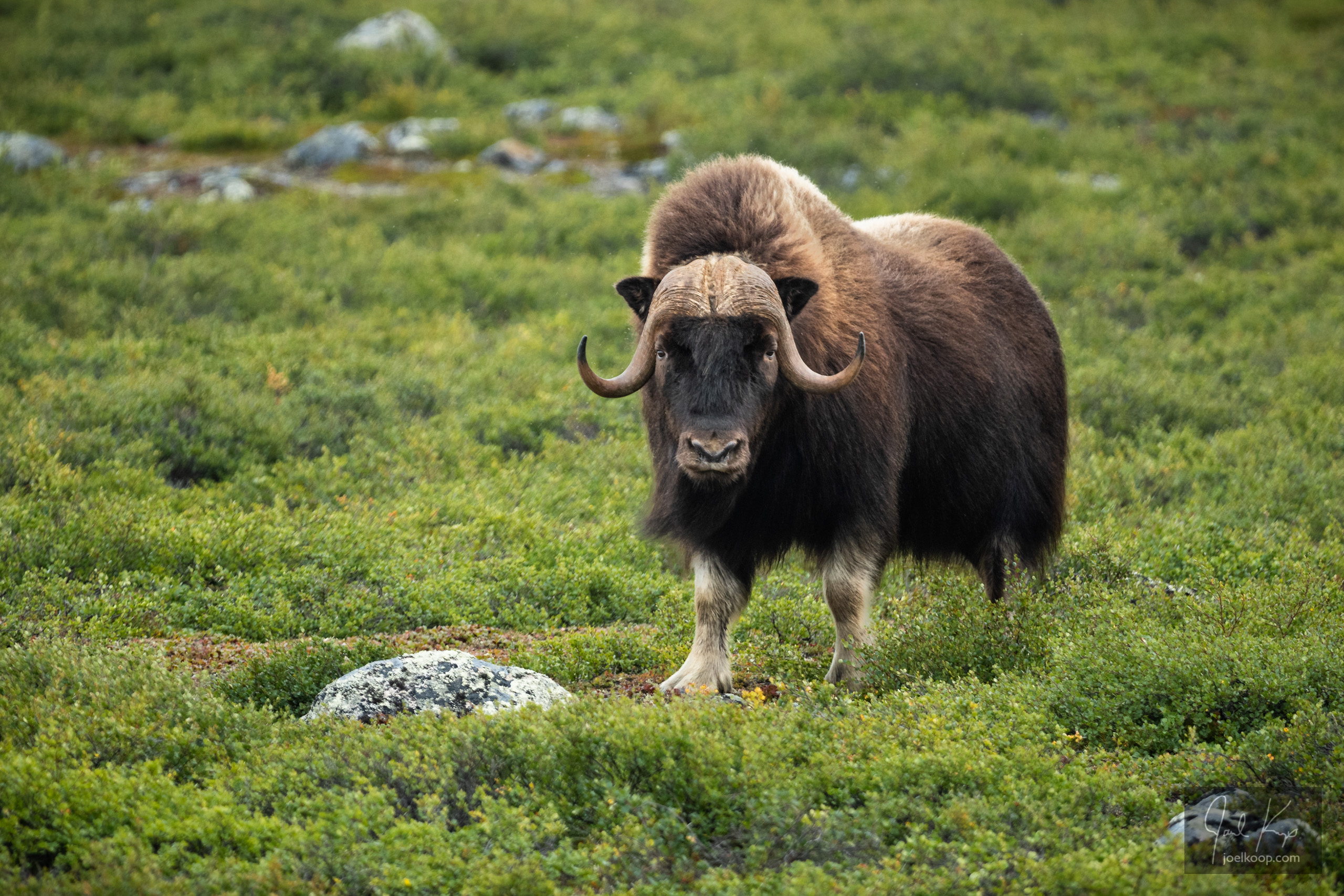
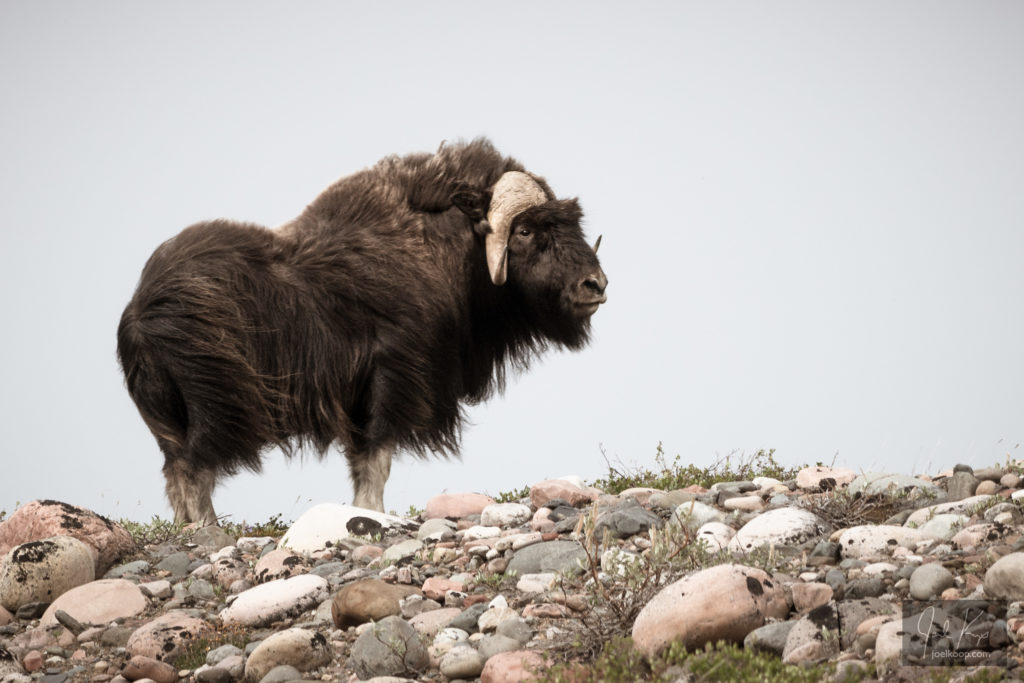
A large muskox on the banks of the Hood River, Nunavut

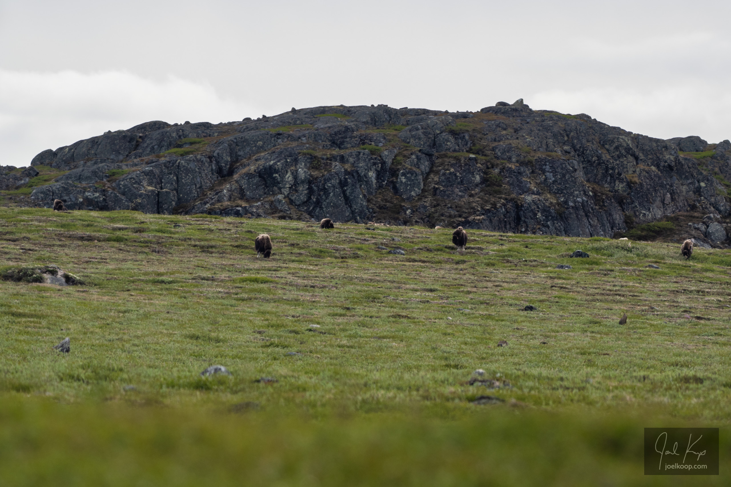
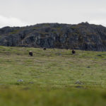
My first glimpse of a muskox was from a canoe on the Hood River. There was a herd of dark specks far away on the gentle slope of the riverbank near the Wright River confluence. We pulled over, went up on shore, and watched them for a while. They were very far away and I don’t know if they ever noticed us.

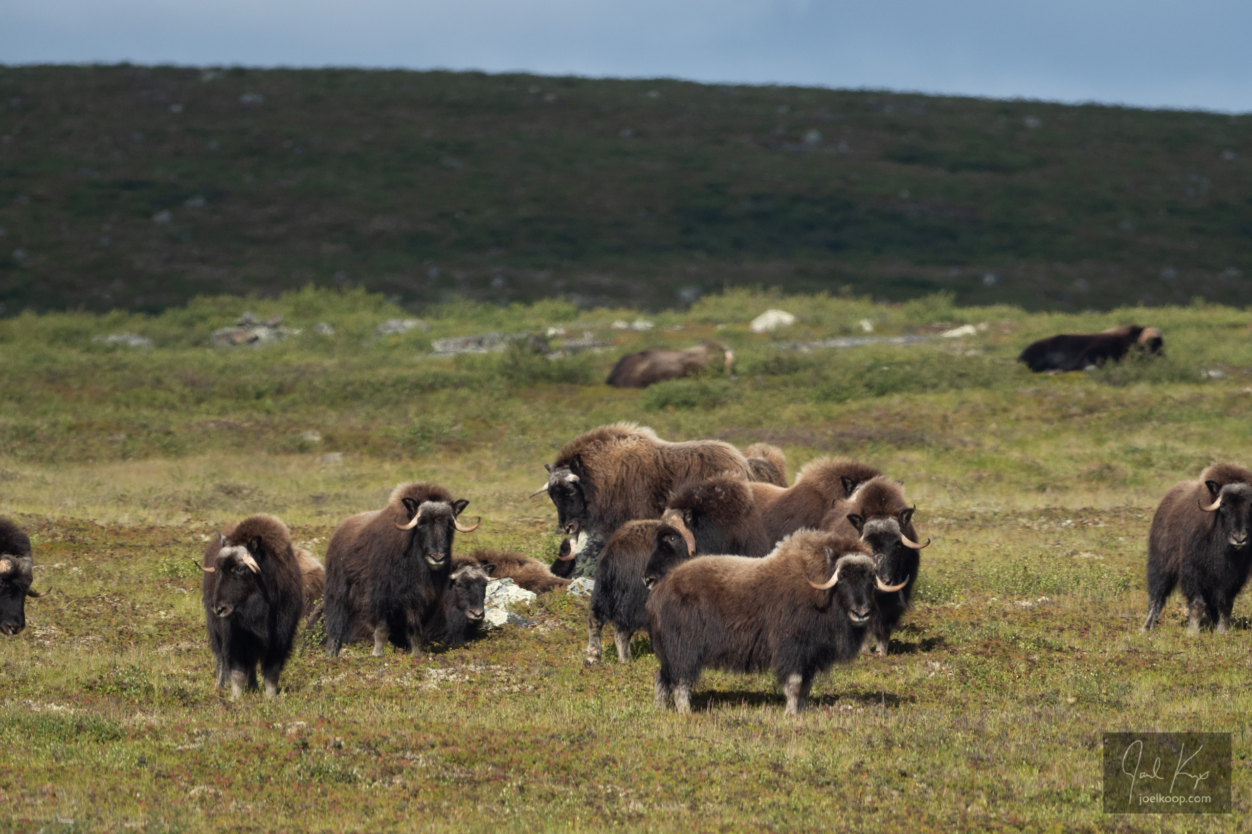
Some of the rest of the herd peering at the strange out-of-place creatures floating on the water.

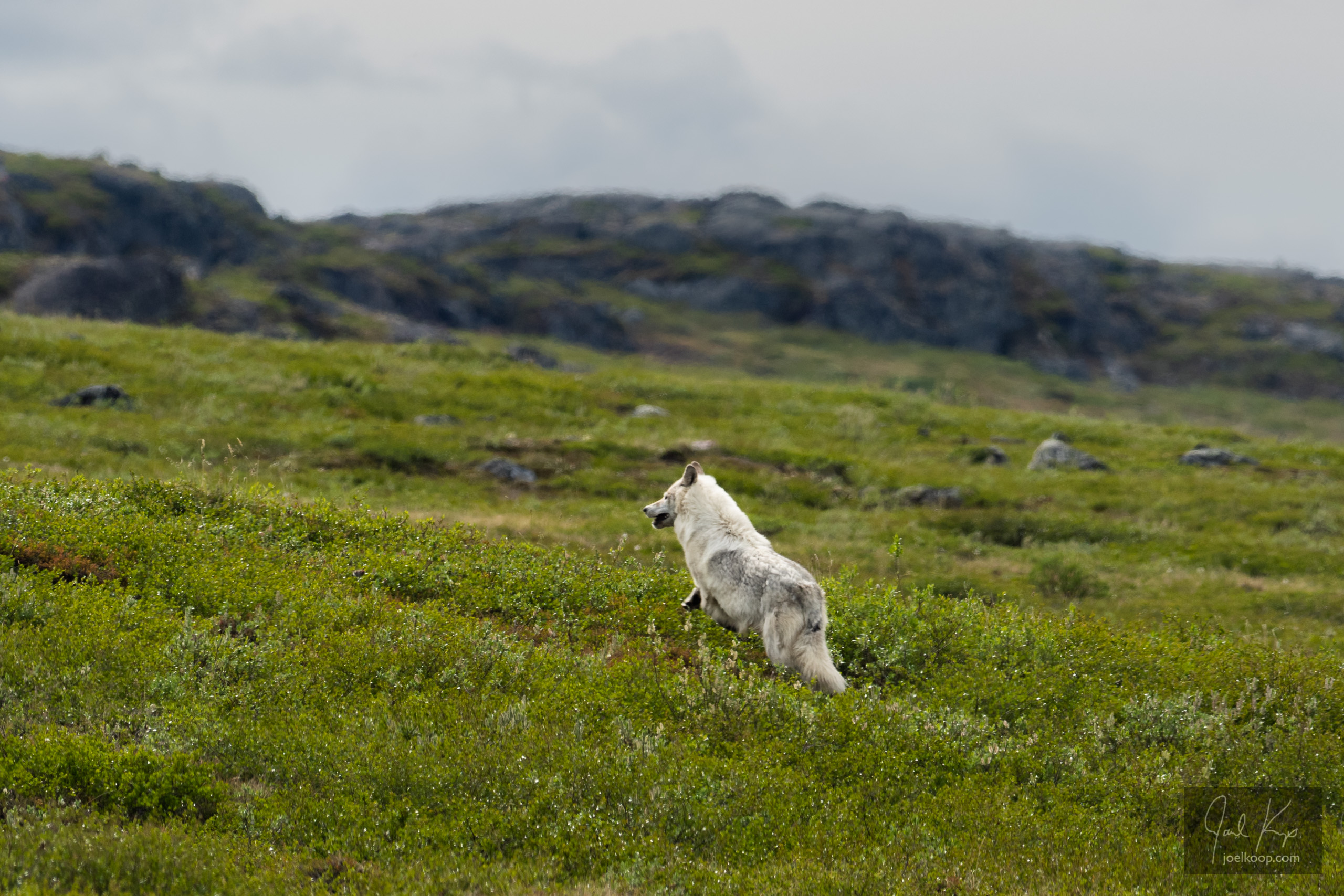
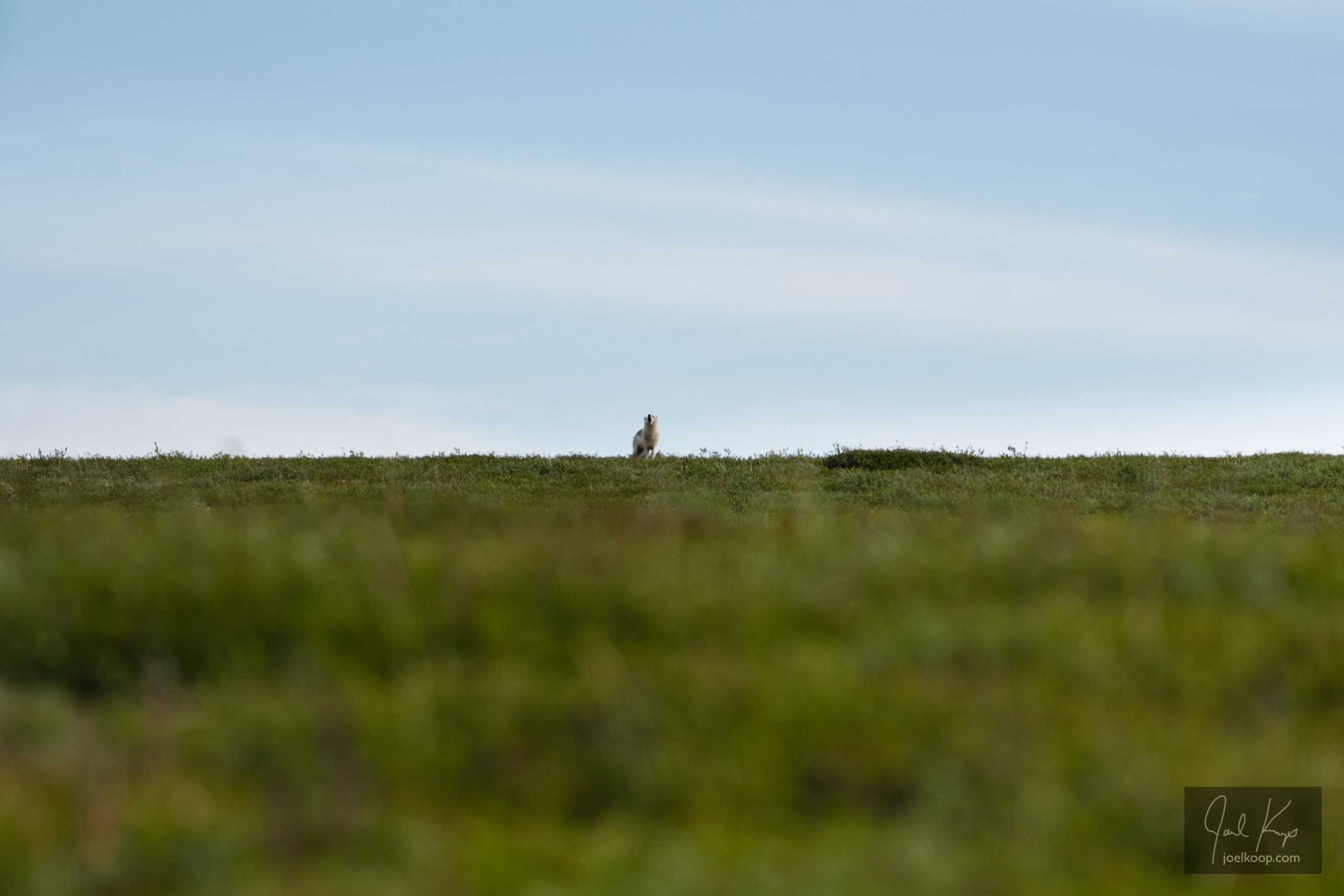
The second time we saw them, we had pulled to the side of the river to check out a promising sandy bank with signs of wolves. At first it looked like the wolves hadn’t been there for a while – the signs were all old. And then, as we were taking one last look around, large white wolf exploded out of the ground just a few feet in front of us. It bounded away until it reached a ridge where it could look back at us and then it started howling. As it was running up the hill, we noticed a herd of muskox grazing on the same ridge. The muskox were keeping an eye on the wolf, but didn’t look too worried.

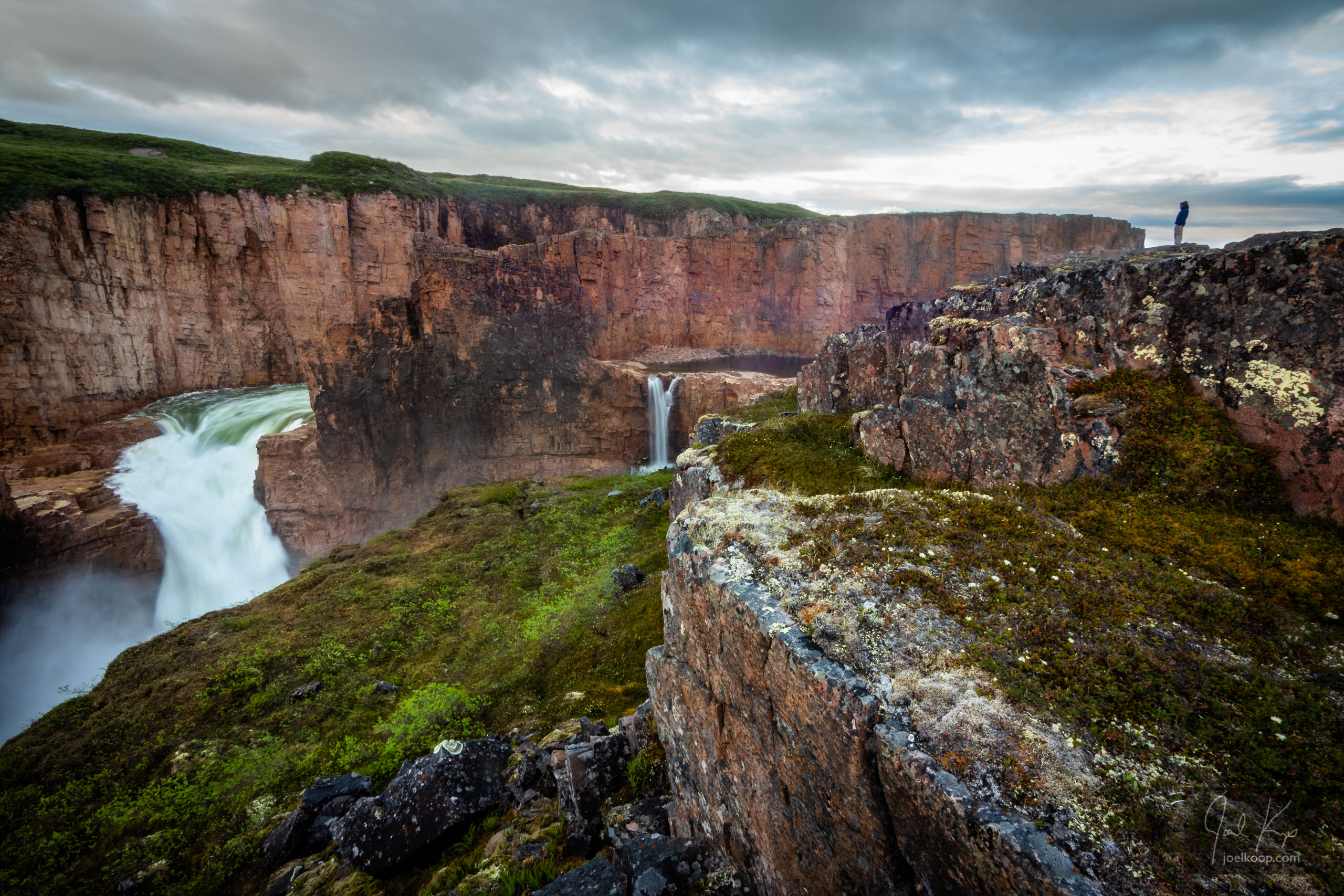
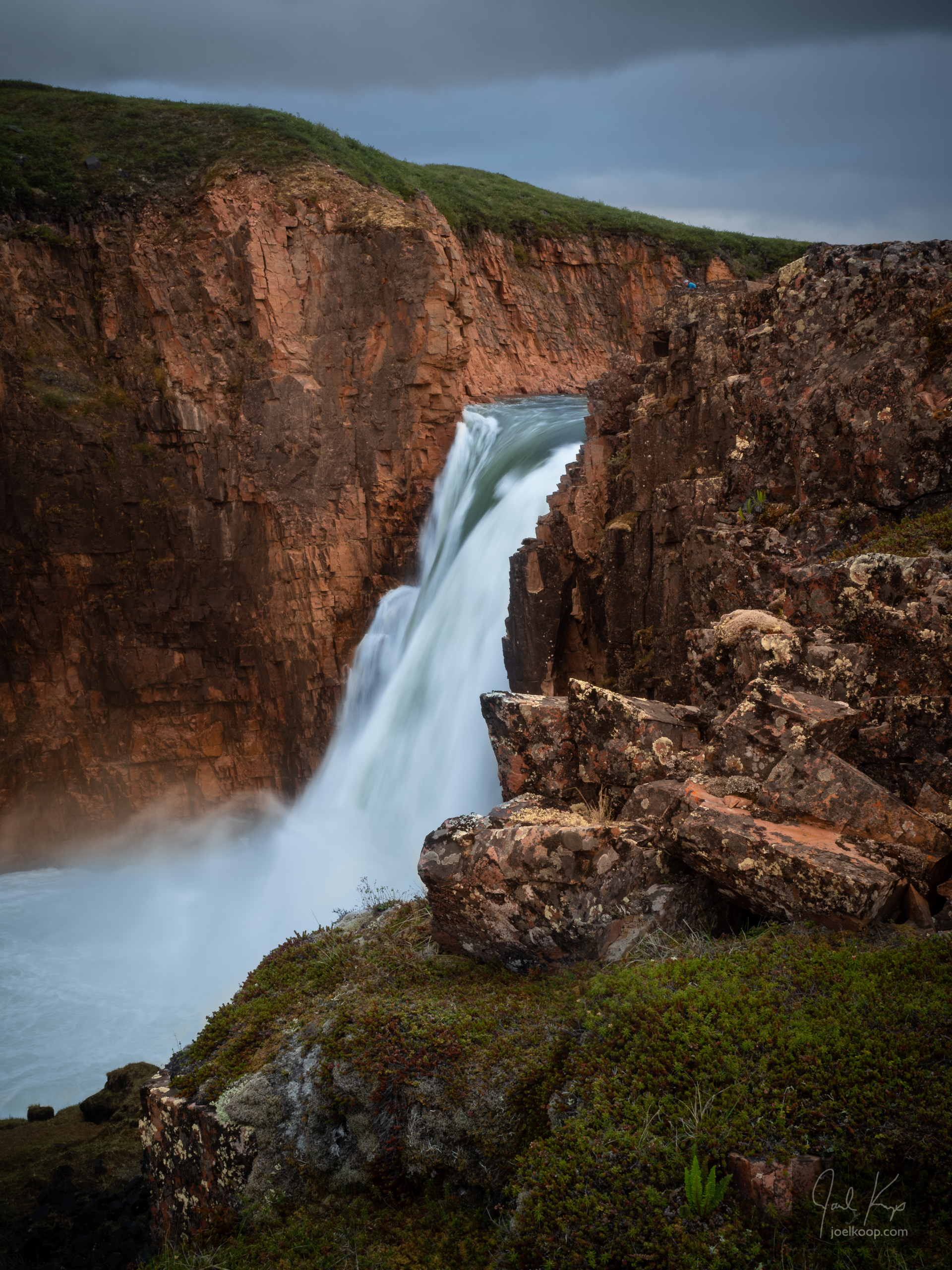
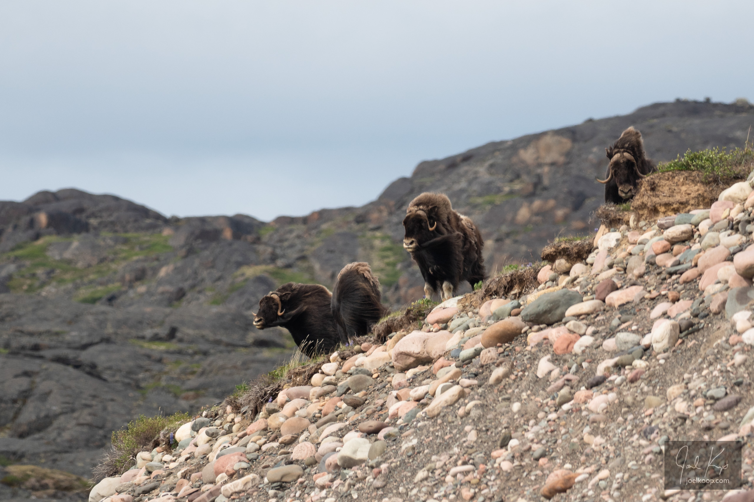
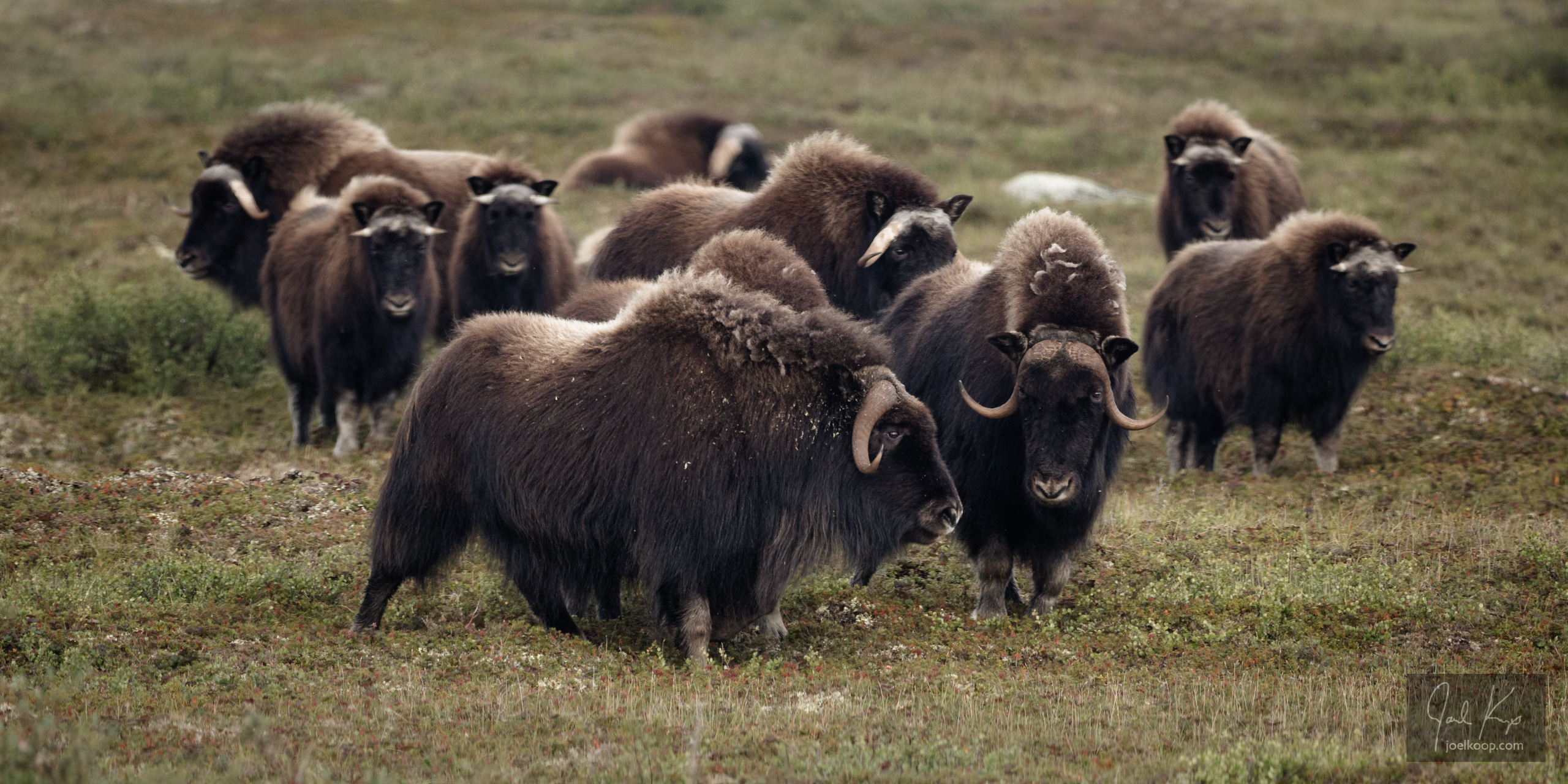
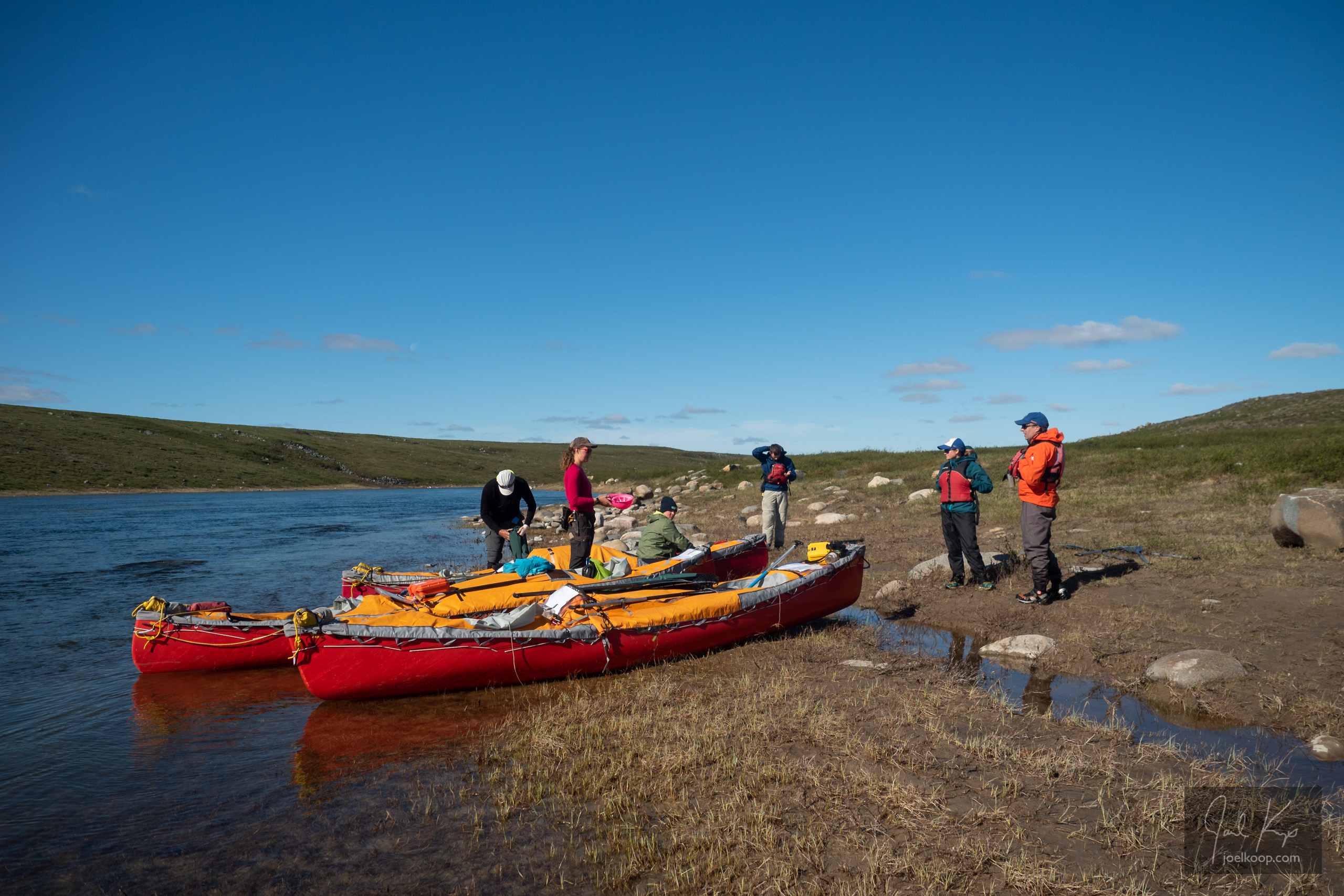
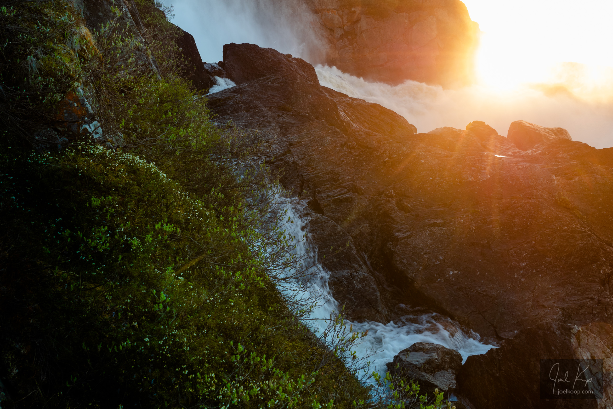
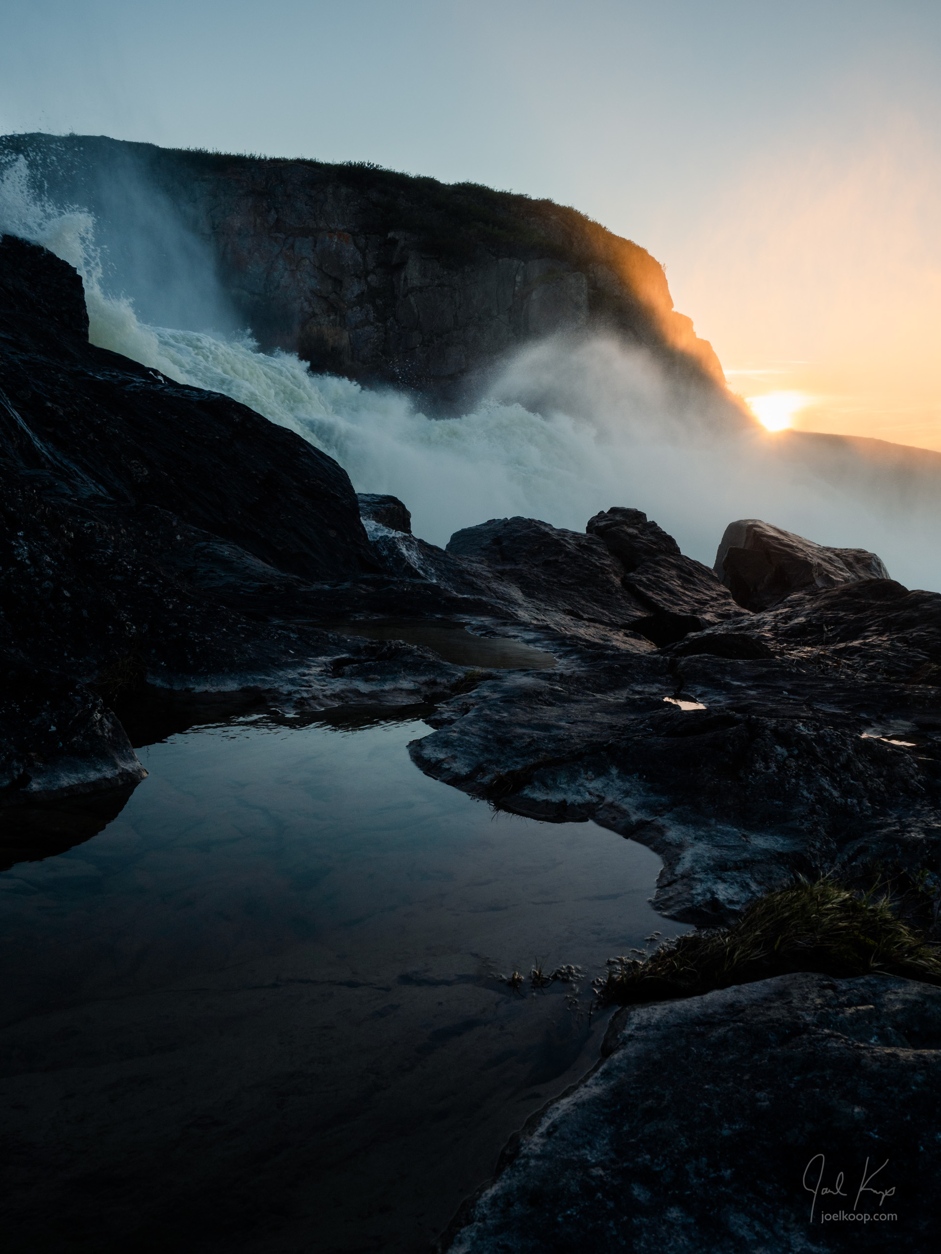
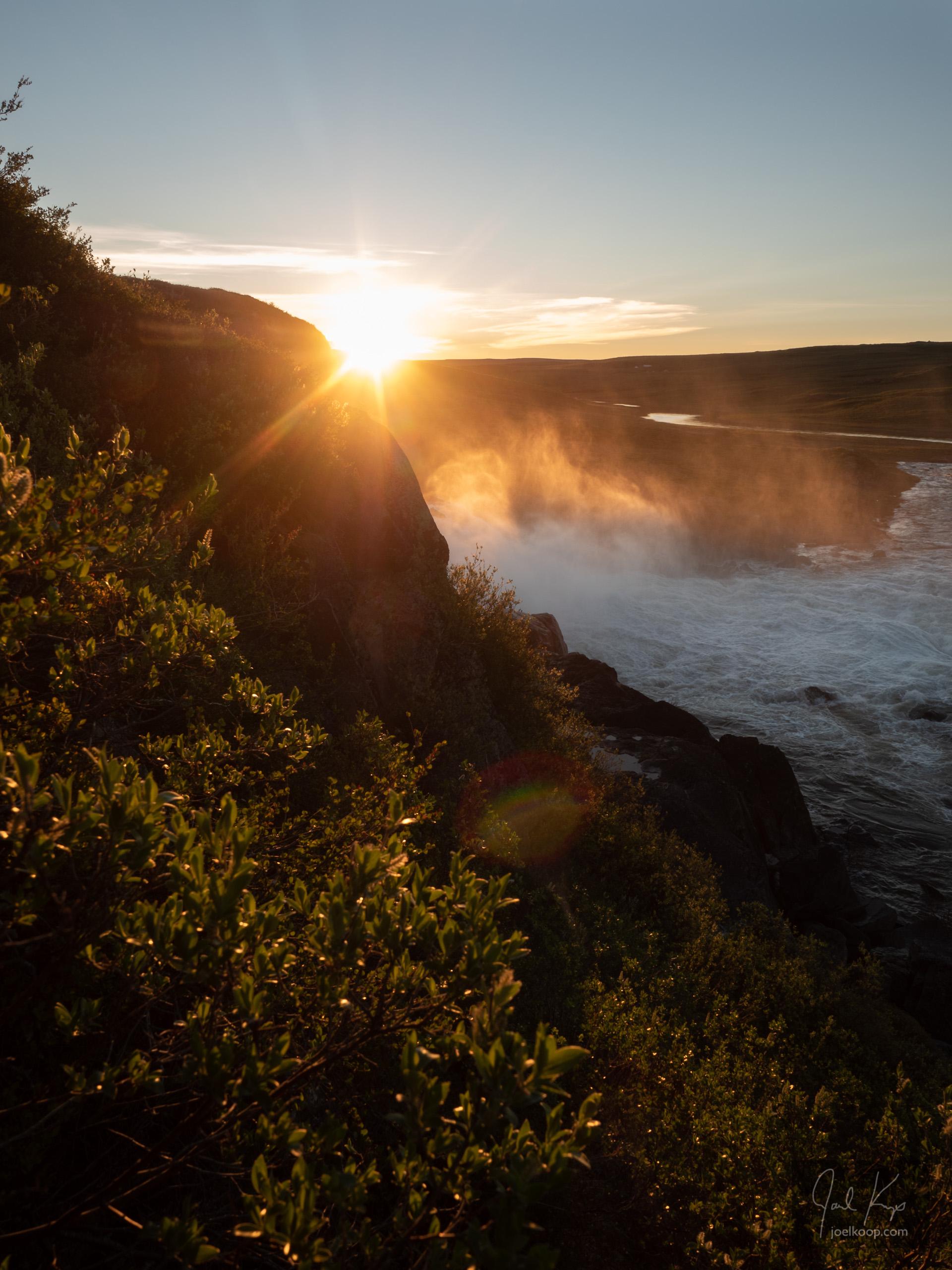
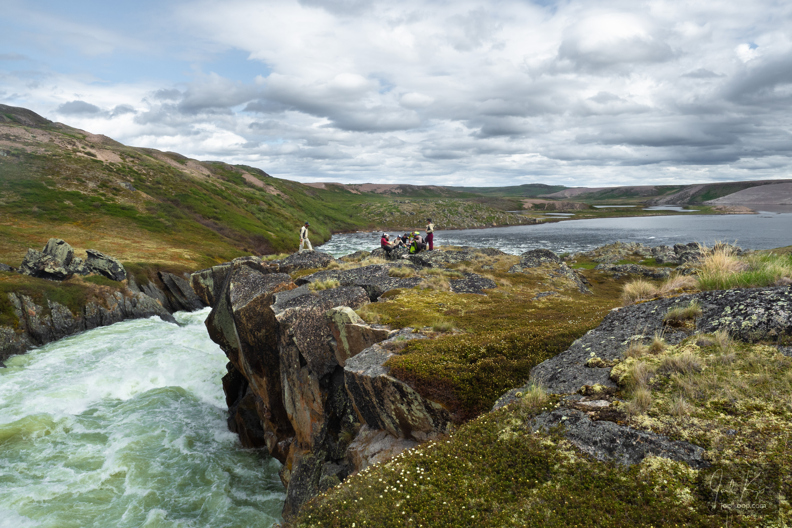
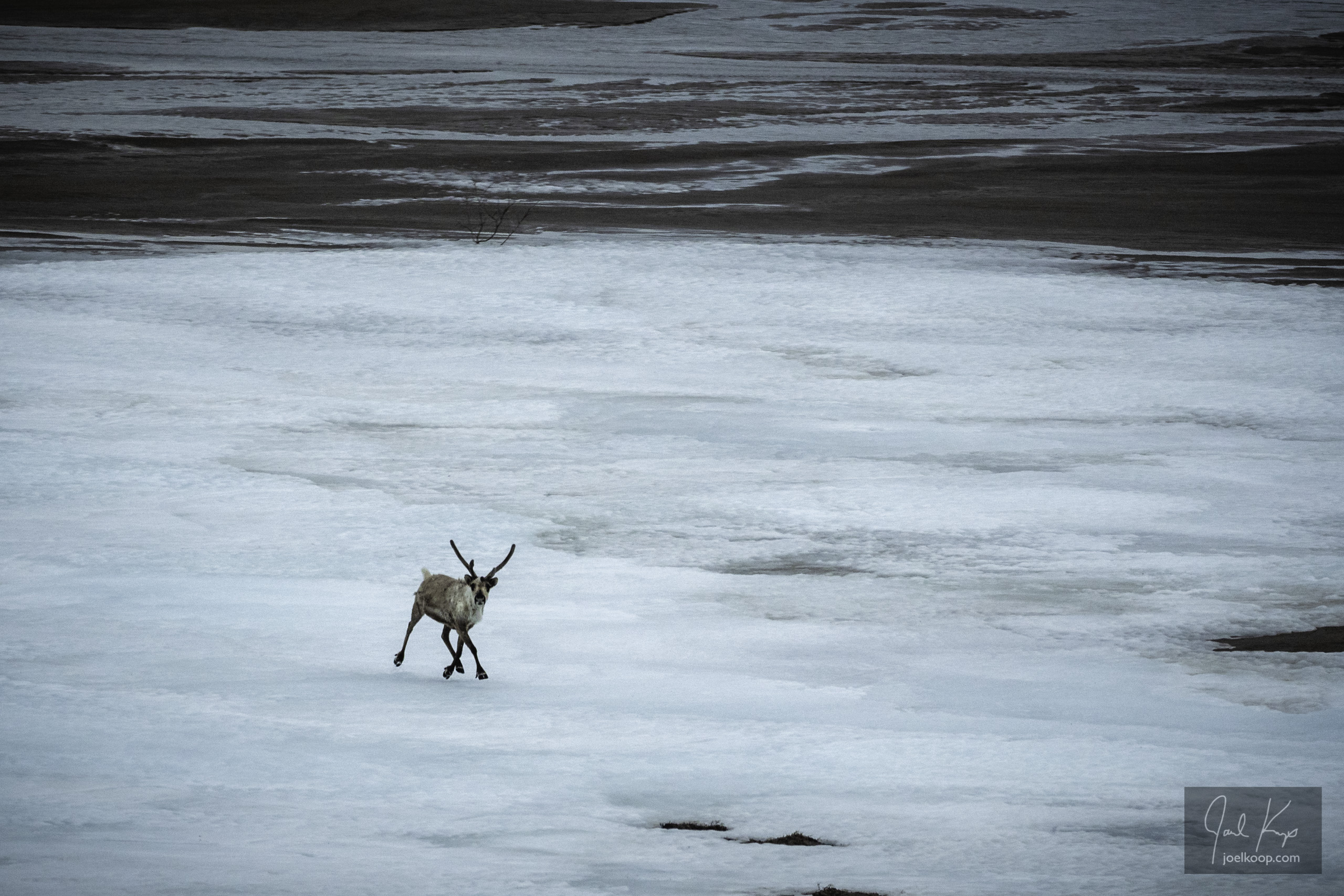
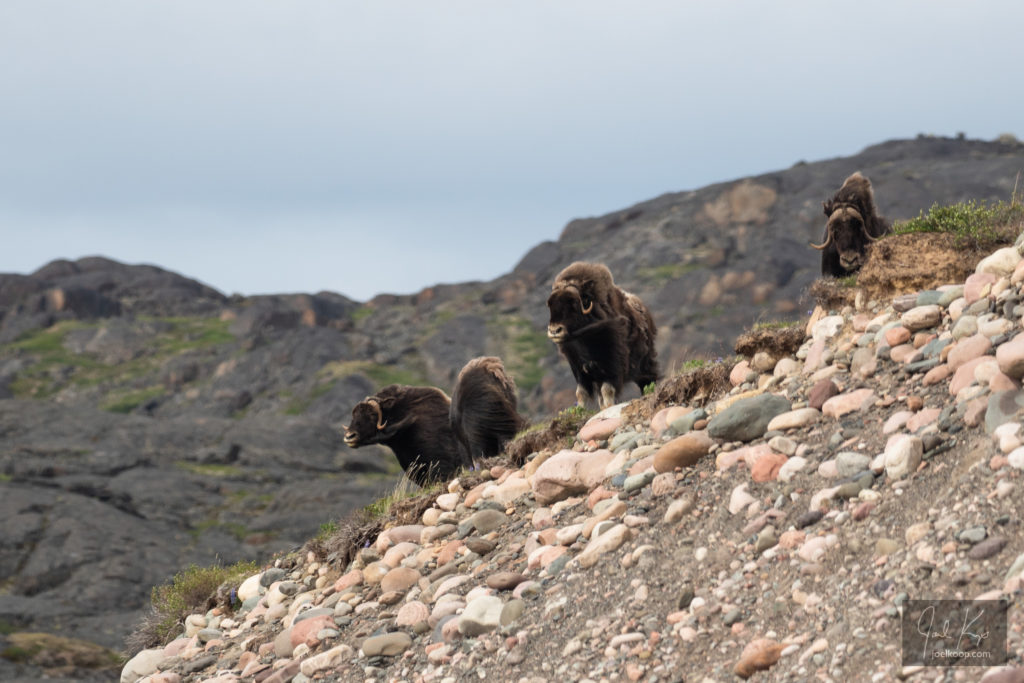
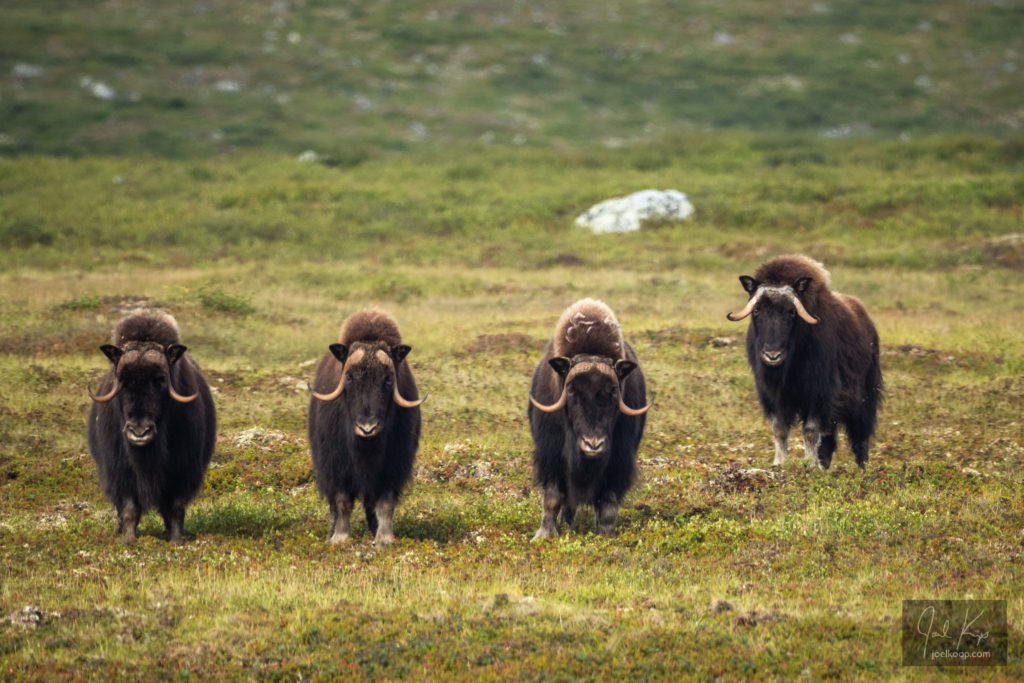
These first few photos are from the third time we saw them. We were canoeing through a technical part of the river with lots of rocks, waves, and fast water. They were watching us from high above on a gravel bank, but quite close. We found an eddy (a calmer section of water below something blocking the current) by the shore and watched them for a while from the canoes. The wind was blowing through their long hair and occasionally blowing away parts of their lighter-colored winter coats. Later on in the summer I’d find a lot of this this qiviut (muskox wool) snagged on birch and willow around MacKay Lake. It is one of the warmest, softest, and most expensive fibers you can get.

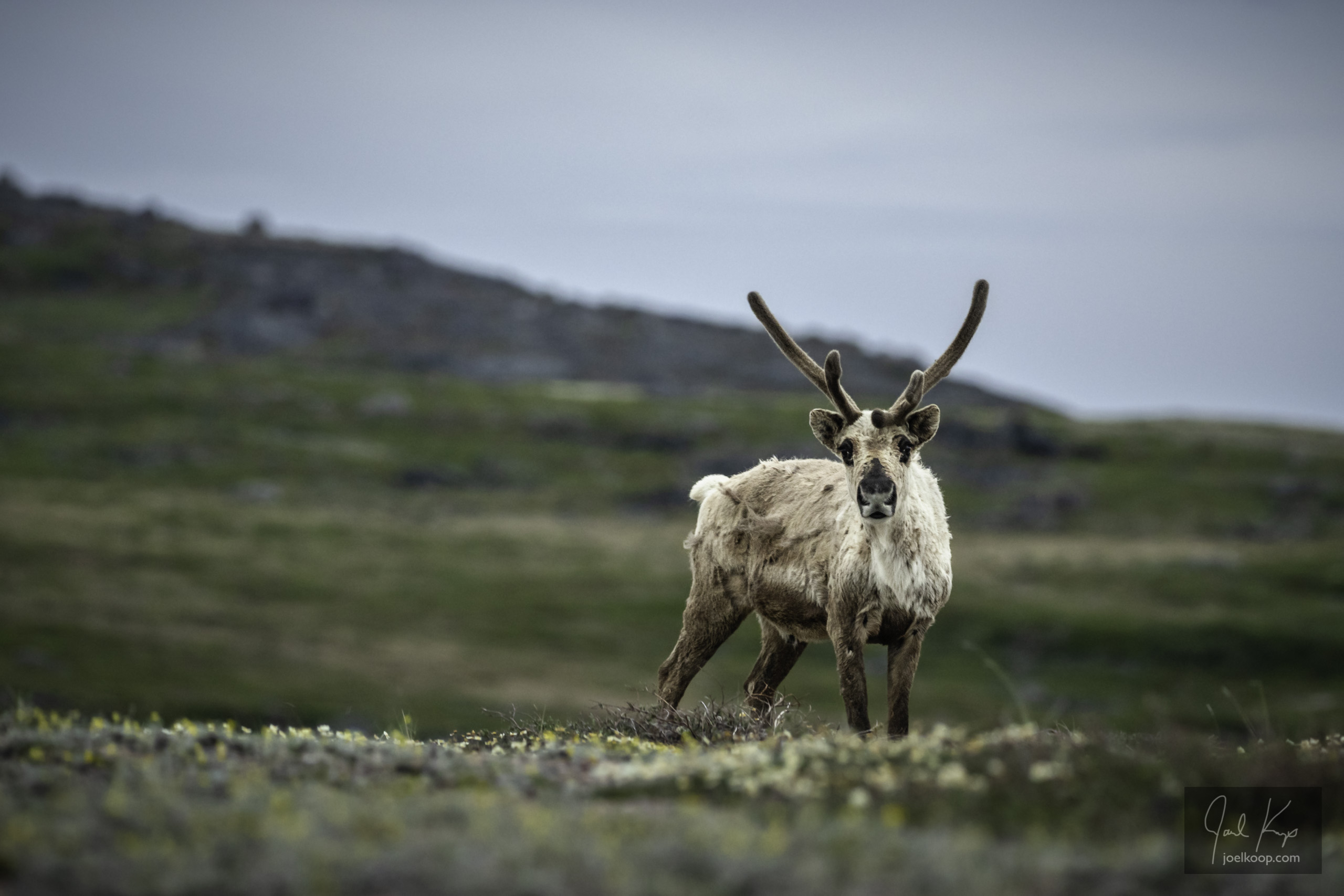
Throughout the summer I saw quite a few muskox, both lone bulls and herds. When a bull gets too uppity and challenges the leadership, they can get kicked out of a herd. We saw a few of these lone bulls roaming around. Once, near MacKay Lake, we were at a research site sampling birch shrubs when we saw something moving on the horizon. Worrying it was a grizzly, we got everyone’s attention and got into a group. We then watched as a bull muskox lumbered towards us. It disappeared into a gully so we got up on a large rock to get a better view. When it reappeared, it briefly stopped, looked at us, and then kept coming closer. It seemed curious, trying to figure out what we were. It came close enough that we could watch it’s nose dripping and hear it breathing. At this point it was close enough that we were getting a bit nervous, and one of us moved. That was enough for it to turn and run, long hair billowing majestically behind it. That was a ideal reaction – if they start rubbing their front leg against their face, then you know you’re in trouble.

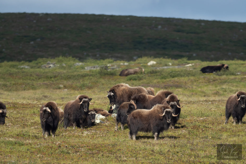
The largest herd we saw was more than 20 muskoxen on the shores of MacKay Lake. That was also when I got to hear the most impressive animal noise I’ve ever heard. As we were floating closer in our canoes, the dominant bull let out what can only be described as a rumble that I could feel as much as hear.

In the 1800s, muskox were almost extinct. They had been hunted by whalers, fur traders, explorers, and Inuit until there were almost none left. They were a good source of meat and fur, and were easy to hunt. Their defensive reaction is to line up in front of their young and charge if anything attacks. While that’s a great defense against wolves, it is a very poor defense against rifles. In 1917, the government of Canada banned hunting muskox, and in 1927, created the Thelon Game Sanctuary to help muskox populations recover. Now muskox populations are rising fast while the caribou populations are plummeting.

In 1897, Charles “Buffalo” Jones, a rich American, took it upon himself to go up north and lasso some young muskox to take back down south and breed in captivity. He saw it as his God-given duty to “have dominion over every living thing”. He went up north, built a cabin by Great Slave Lake to spend the winter in, and the next year found a herd out on the tundra. Against the wishes of the local people, he lassoed four calves and started to lead them south. One morning he woke up to find the four calves with their throats slit, with the knife left next to them. His mistake was a classic one – barging in without any understanding or respect. He sort of got the message and left the muskox alone, only to head out to an island in the Bering Sea to try to establish a breeding farm for Silver Foxes. His full story is maddening, fascinating, impressive, and ridiculous. This is a quick version.

Grizzlies on the Hood

Grizzlies grazing on the banks of the Hood River.

Below the Wright River confluence the character of the Hood River changed. It started feeling like a legitimate river with a significant current. It started to get a bit splashy, so we put the spraydecks on the canoes. This let us keep paddling instead of constantly bailing water out of the boats. It turned out that our packboats were all leaking a bit, so we occasionally had to stop and bail anyway. At one point we spotted a couple grizzlies grazing on the bank. We watched them for about 15 minutes before they spotted us. The younger, lighter colored bear took off along the shore, swam across the ice-cold river, and disappeared over the north bank. The mother (we think) followed shortly after, keeping a close eye on us.

We started paddling with spraydecks, as there were frequent small rapids.

Wright River

Looking east towards the Hood River with the Wright River coming in from the south.

The short day from Kingaunmiut Falls to the Wright River confluence was possibly the smoothest day on this trip. The river was easy and glassy calm. We stopped to watch a few muskox grazing on the tundra far up the bank. We got to the Wright River early and had lots of time for a walk. We found old Inuit tent rings, fascinating rock formations and frost heaving, beautiful falls on the Wright River, and a school of Arctic Grayling swimming in the pool at the bottom of the falls with their tall dorsal fins constantly cutting through the still surface.

Falls on the Wright River as it tumbles towards the Hood.

Kingaunmiut Falls

After Skull Rapids, we had a couple uneventful days of paddling and portaging. Then we got to a slightly longer portage, which would be just a small warm-up for our real portage (more on that later). But at the end of this long sweaty ordeal, we got a beautiful, flat campsite at the bottom of Kingaunmiut Falls, with a Peregrine Falcon (Falco peregrinus) scolding us for a bit before it accepted our presence as inevitable. Or maybe it realized we couldn’t scale the cliffs to get to its nest. This is also where we saw a distant herd of muskox for the first time.

Notes:
1. All of these photos were taken near midnight.
2. I was saying it “King – gun – mute”. If any speakers of an Inuit language are reading, I’d love to be corrected!

Research by Canoe: RangeChange.ca

A large part of my last summer was spent researching shrub growth just above treeline in the Northwest Territories. I’ve been blogging about the experience and posting photos on our research project website at https://rangechange.ca. I’ll get back to some more Hood River posts here soon, and hopefully I can fit in my snowshoeing trip too before my adventures for this summer begin. Planning is in full swing!

I’ll leave you with one teaser – many more photos on the RangeChange.ca website!

Our camp on an esker beside the Snake River which flows into MacKay Lake. We stayed here two nights – we were constantly moving to reach new research sites.

Skull Rapid

Having lunch above Skull Rapids on the Hood River

Skull Rapid – it’s an ominous name for a long and violent rapid, crashing over and through large boulders. This was our first portage of many, right at the outlet of Esker Lake. We figured out how to organize our gear, how to tie loose gear on to packframes, and how much we could all carry. It was a short portage at only a few hundred meters, and we completed it fairly quickly and had lunch on the bluff overlooking the rapid. The rapid is named for an old muskox skull, slowly decaying in the mats of flowering labrador tea (Ledum sp.).


Last Caribou in the Hood?

If we’d done this trip twenty years ago there’s a good chance we’d have canoed through herds of thousands of caribou. The north is peppered with stories of watching thousands of caribou stream past for hours, but not recently (at least in this part of the arctic). The Hood River is in the Bathurst Caribou range – it actually flows right through the traditional calving grounds, although those may be changing a bit too. We were hoping to see caribou on this trip, but we knew the chances of seeing a large herd was small. In 1986 the Bathurst herd was around 500,000 caribou, in 2015 it was 20,000 and today it is 8,200 (source).

In late June we pulled our canoes over the last bit of ice on Esker Lake. We got to the end of Esker Lake and camped on a large point of sand covered with Mountain Aven (white flowers with a yellow center). Although it was a lot of work hauling our gear up the sandy bank, the camping spot was spectacular. After camp was set up, supper cooked and everyone fed, most people headed to bed. I was tired, but I couldn’t pass up a short hike. As I walked up the sandy ridge (I don’t actually think it was an esker – it was too large of a sandy area) I admired the large ice-covered delta where a small river flowed out into a bay on the lake. I got to a high point and sat down to appreciate the view. Then I spotted something moving.

There was a lone caribou picking its way over the ice of the delta. I watched for a while – it was slowly getting closer to our camp. I’d heard about someone holding up their arms too look like caribou horns so caribou wouldn’t be scared of them and I thought I’d try it even though the caribou was still at least 500m away. I stood up and put my arms up. I saw it turn its head towards me and pause. And then it started running – towards me!

I was surprised, but I kept my hands up as much as I could while still snapping a couple pictures. The caribou ran across the delta, right in between the tents in our camp and up the ridge towards me. It got really close and I couldn’t resist – I dropped my arms to take some photos. And the caribou stopped. I’d lost my antlers and now it didn’t know what to make of me. It studied me for a minute, tilted its head this way and that, and eventually decided that I wasn’t a caribou. I may be anthropomorphizing, but that was the saddest caribou I could imagine trotting away from me. It went over a rise and disappeared.

I felt so sorry for that lonely guy. He looked so hopeful for a friend and I’d let him down.