Guiding Memories 4

Navigating off-trail is an interesting exercise. It is much slower than backpacking on a trail. There are logs to hop over or crawl under, there are steep slopes, there are roots to trip over and willows to push through (all with heavy packs). Over time, you learn to pick easier routes, understanding the difference between meadows and swamps, north-facing and south-facing slopes, and when to dead-reckon your way and when to estimate. There’s always more to learn!

This series is during spring 2020, when all my trips are likely going to be cancelled for this next summer due to COVID-19.

Guiding Memories 3

Here we are loading up canoes on the North Saskatchewan before leaving in the morning. Being efficient with having breakfast, doing dishes, packing up, and securing all the gear in the canoes is a challenge. There’s a delicate balance pushing people to get going and having a relaxing trip. By this time, the group was doing pretty well.

This series is during spring 2020, when all my trips are likely going to be cancelled for this next summer due to COVID-19.

Guiding Memories 2

We were hiking in the clouds near Abraham Lake. If you ever get a chance to pick an off-trail route, pick the high route. It might require more energy to gain the elevation, but there are better views, it is more likely to be dry, there will be less vegetation to push through. For this trip we were teaching off-trail navigating, so every small group took a different path to our next campsite. Our path included a short ridgewalk, and it was spectacular. We had lunch at the top and the clouds were blowing past – sometimes we were in a cloud and sometimes we had a bit of a view.

This series is during spring 2020, when all my trips are likely going to be cancelled for this next summer due to COVID-19.

Guiding Plans and Memories

I had a summer planned. And it was a good plan. I was going to guide trips all summer – canoeing, backpacking, biking. I was super excited about this, especially as I haven’t had a lot of time to get out this past winter. Now spring is here and everything has changed. Will I have any trips? Will any of us have trips? It’s looking less likely all the time. So I’m remembering trips from last summer and hoping we can get out there again soon! This is first in a series of memories of guiding last summer.

Memory 1
Cooking supper on a cold and rainy night on the North Saskatchewan River close to the Bighorn Dam. This was kind of a miserable night after a hard day – a lot of people were cold and wet despite waterproof layers, we found a campsite just as it was getting dark, and all the firewood was soaked so it was a tough lesson in fire-lighting. Despite the challenging conditions, everyone pulled through and we had a great trip!

Tombstone Territorial Park

We have so many incredible places in Canada that it feels wrong to highlight a particular one – one that I don’t even know that well. It feels like giving the standard advice, when tourists are deciding where to go, of driving through Banff. There’s no denying it’s spectacular, but there’s an intimacy with the land that seems somehow less accessible in these in-your-face spectacular areas. It’s not the real Canada, it’s the instagram influencer of Canada. It’s hard to sell the smaller, flatter, swampy natural areas surrounded by agricultural land that dot the Alberta landscape. And maybe that’s for the best – if they got as much traffic as Banff, they would change significantly.

But the spectacular has the same appeal for me as it does for most people. I’ve wanted to visit Tombstone Territorial Park for years. It has all the in-your-face, mountainous beauty of Banff, plus the northern appeal of the tundra and a relatively low visitor count.

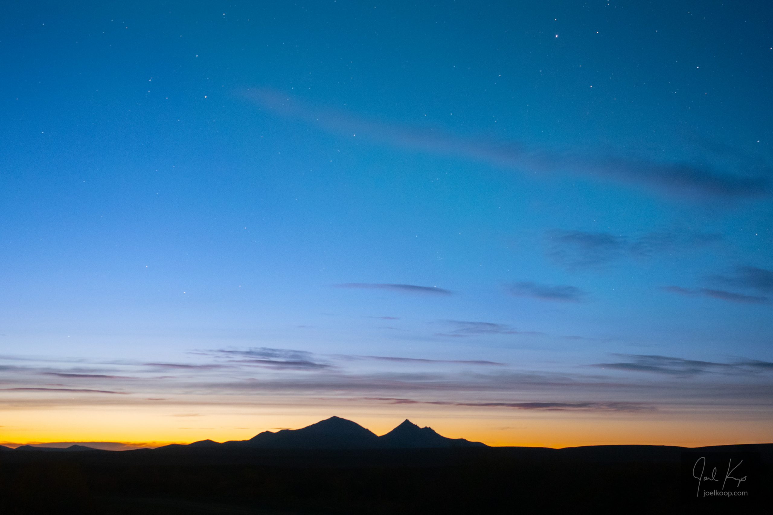
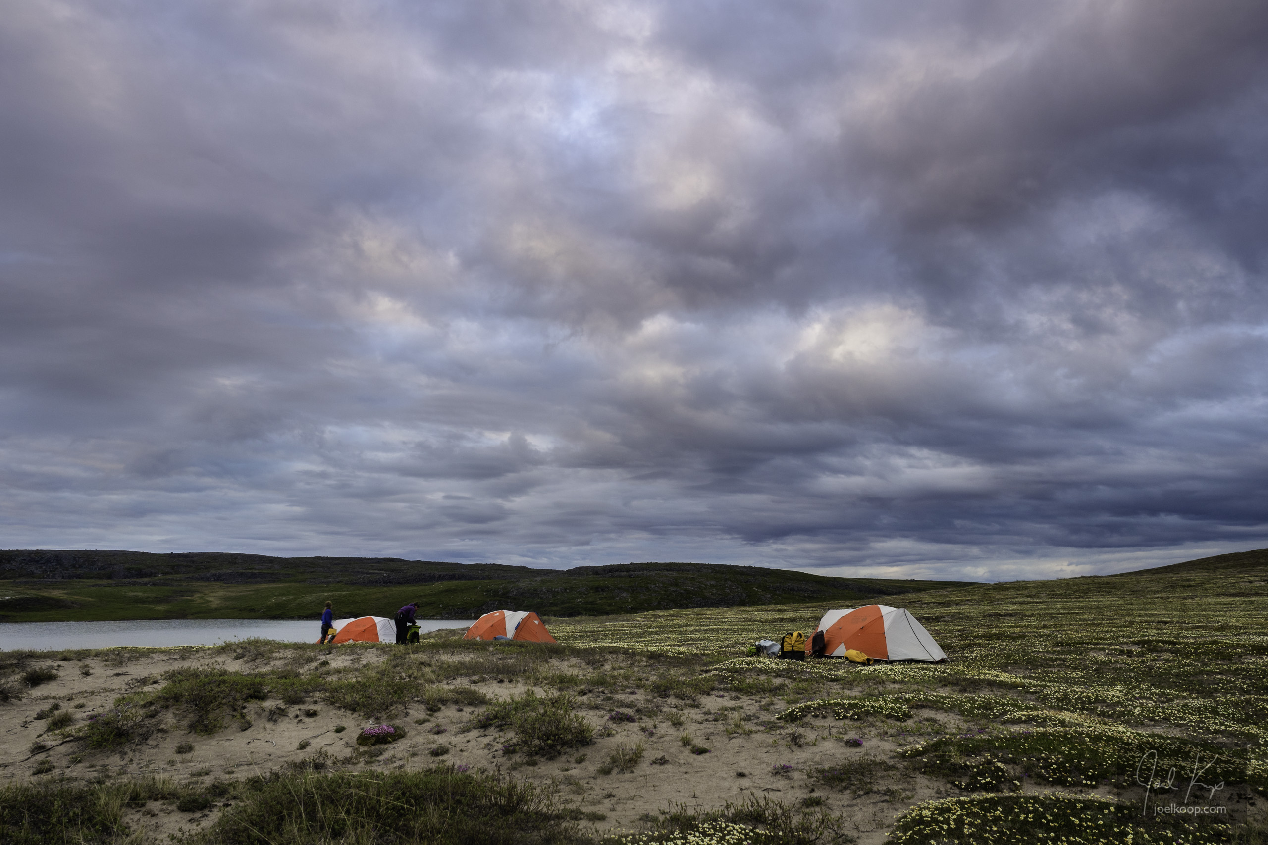
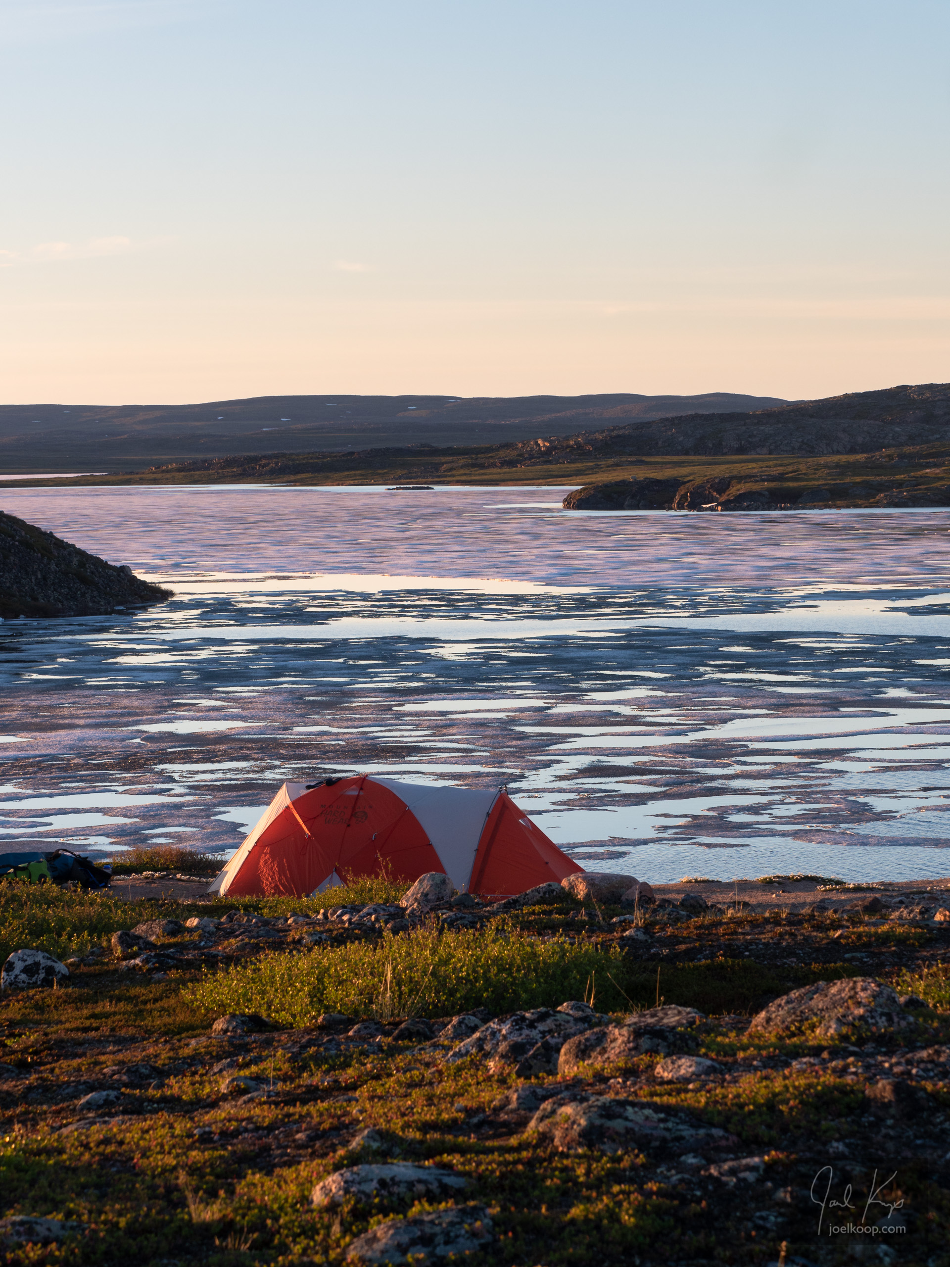
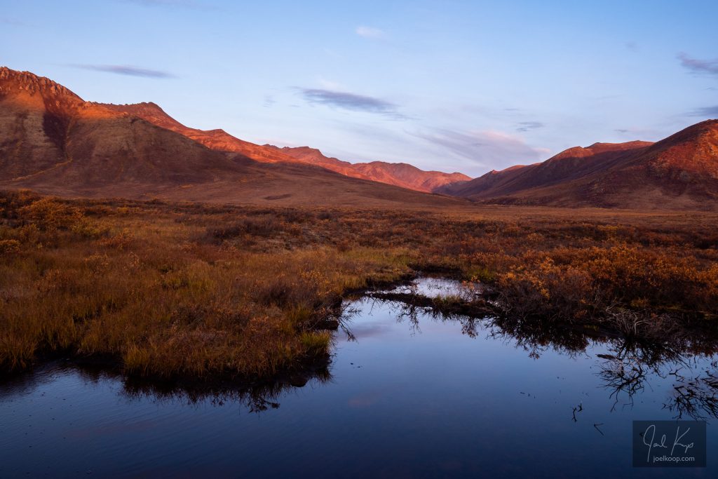
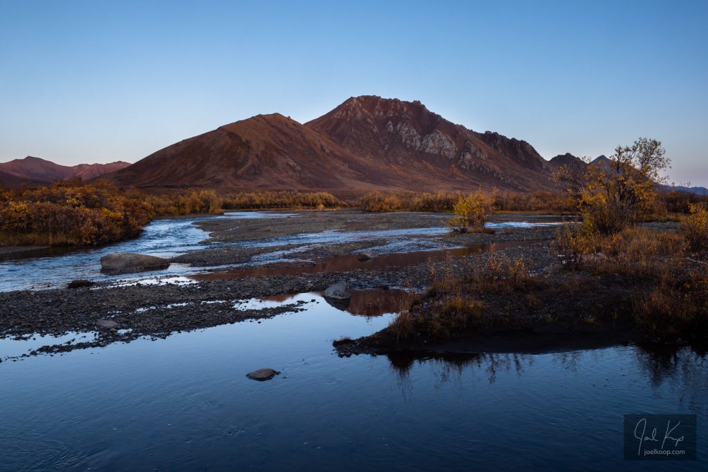
Early morning near the north end of the park.

But it is quite the drive to get there. From the “gateway to the north” in Edmonton, you still have to drive 29 hours north. That sounds long, and it feels even longer. And the trouble with this drive is that there are hundreds of tempting spots to get sidetracked. There are mountains, waterfalls, parks, coffeeshops, rockhunting spots, vistas, wildlife, hotsprings, and more, all calling you to check them out, spend just a bit of time, do just one little hike. But no, you have to keep driving. And driving. And driving. And once you’ve spent the 3 or 4 long days driving you’re finally there. And it is spectacular.

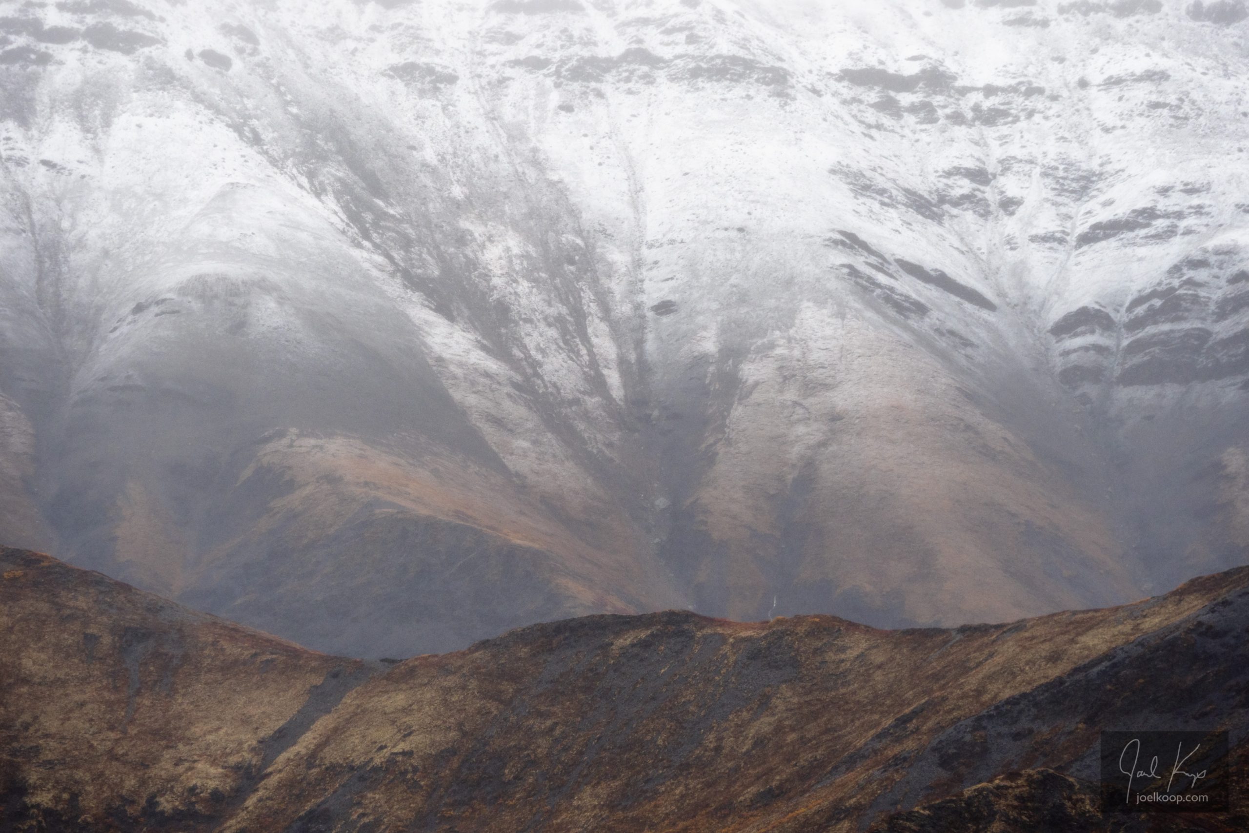
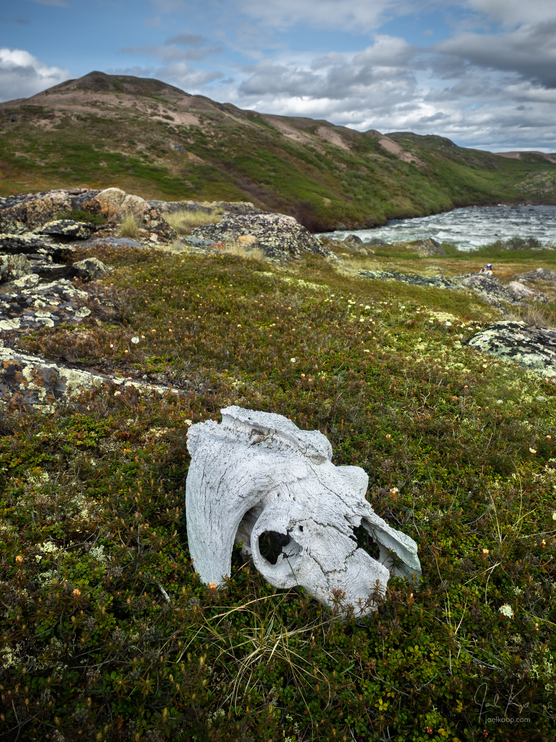
Tombstone is full of interesting textures from erosion, lichen, and tundra growth.

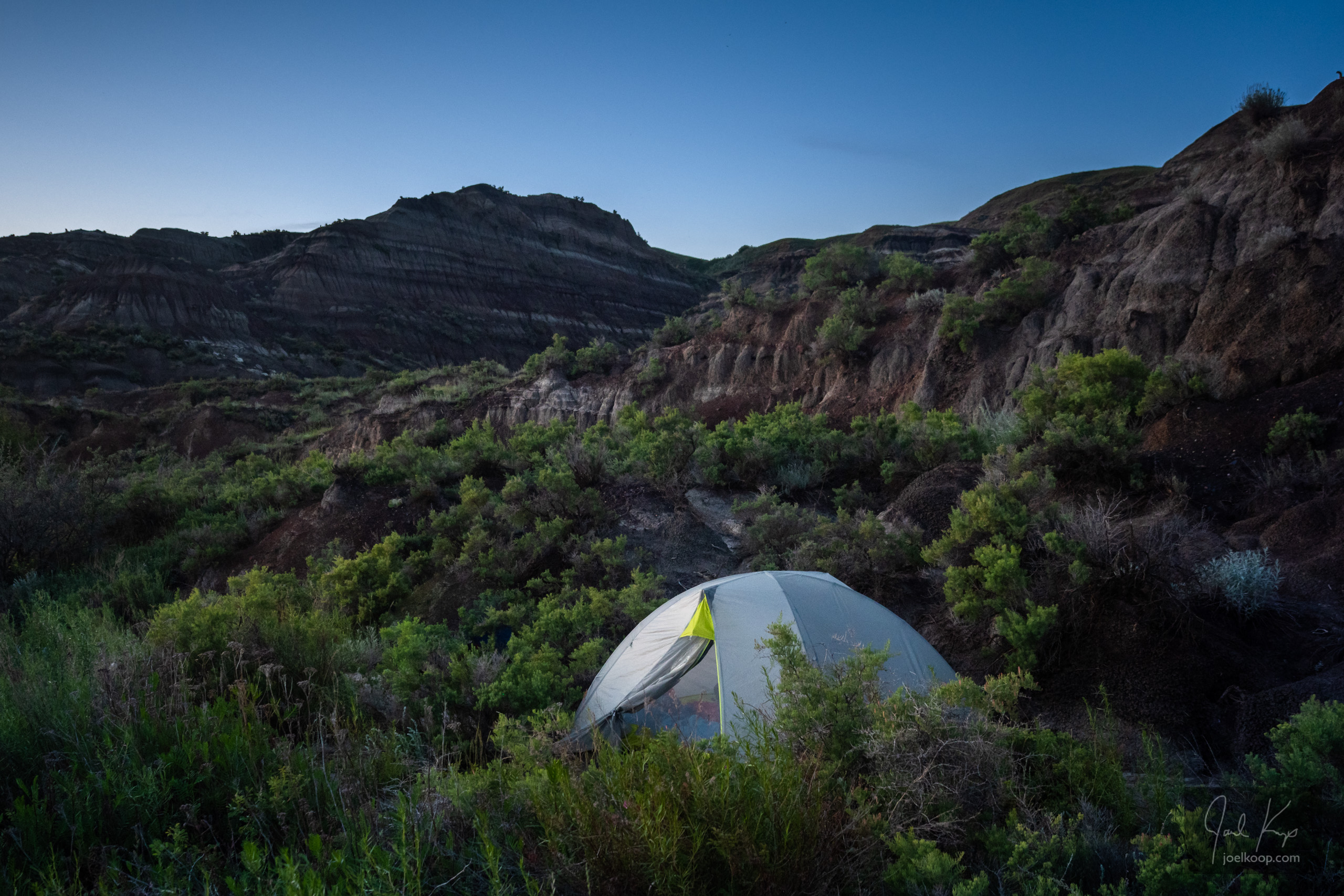
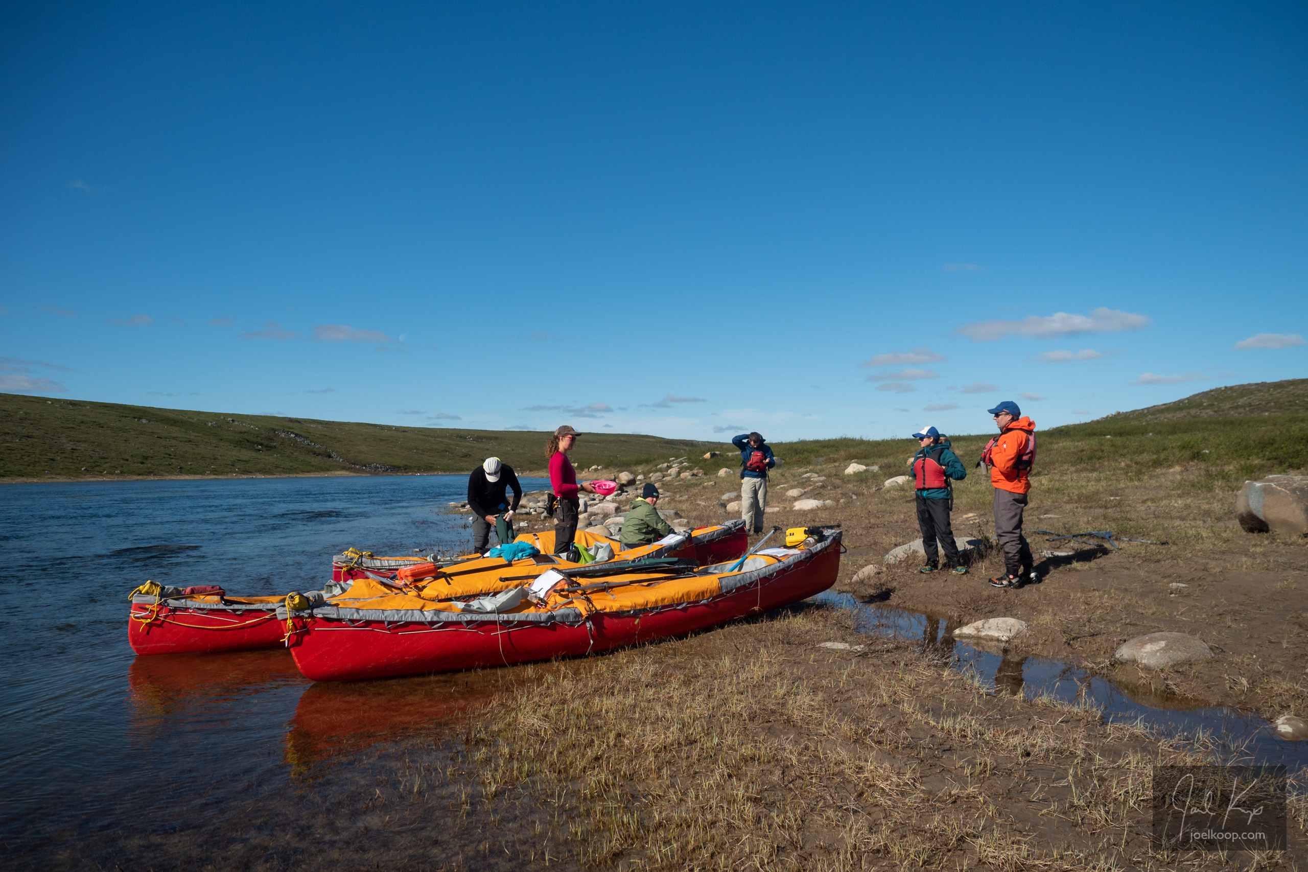
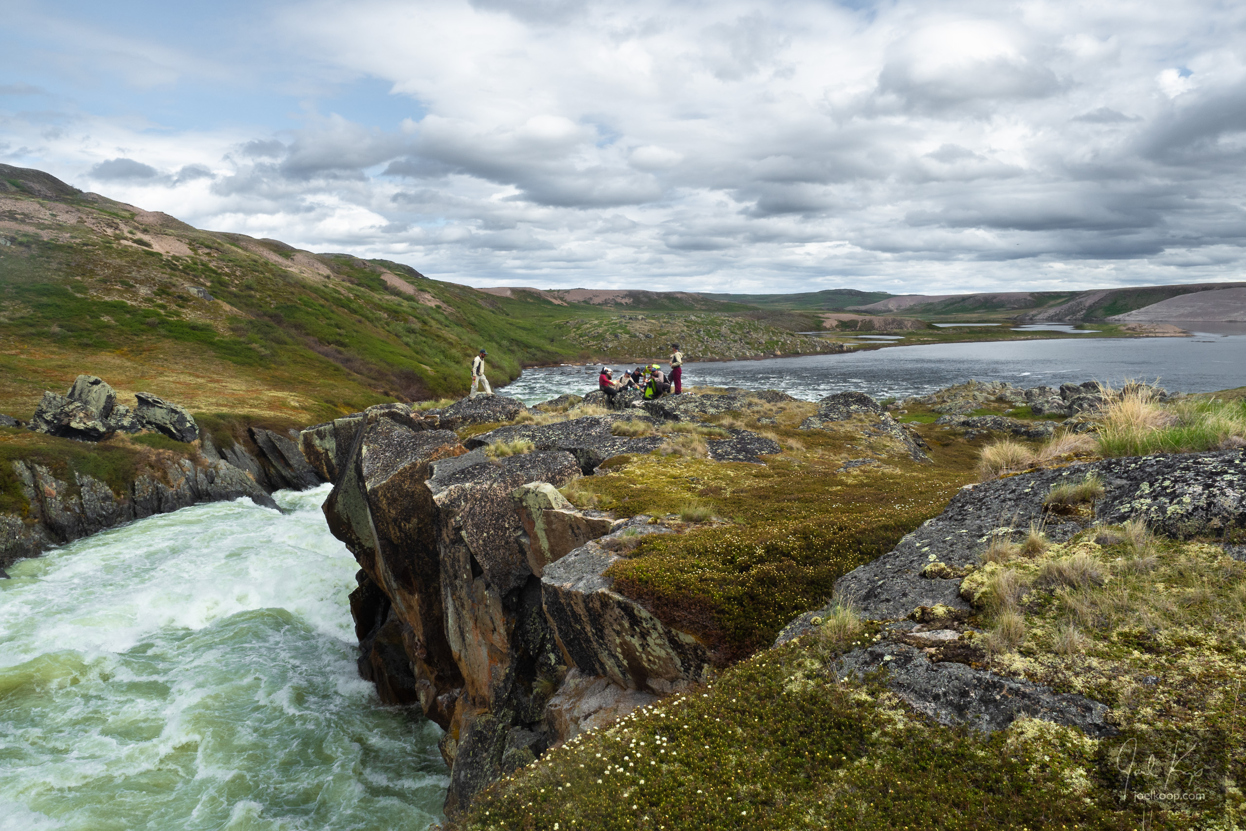
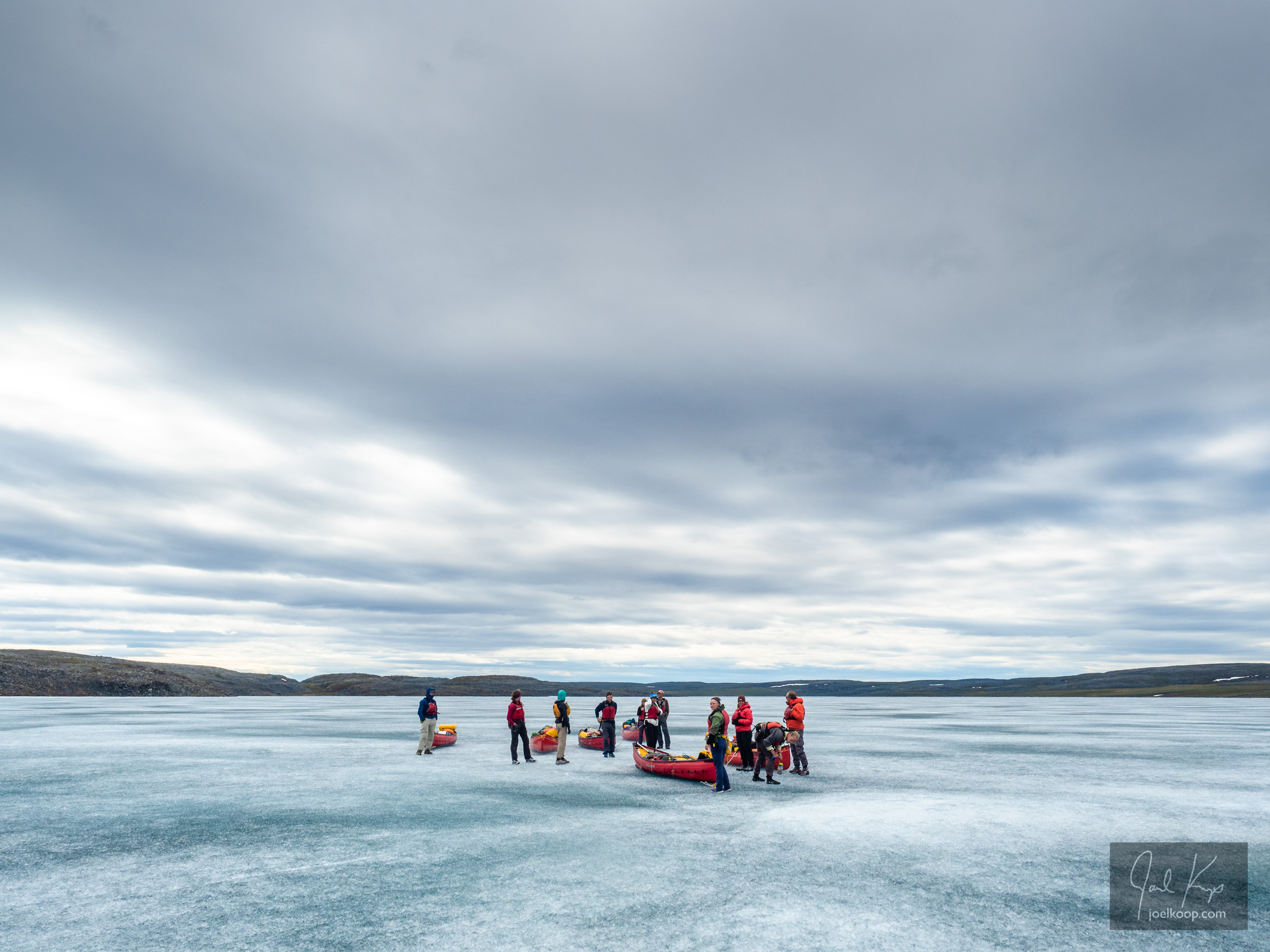
My only advice, if you do have the time to get all the way up here and back, is to make sure you have time to spend in the backcountry. Plan to hike for a few days at least. I got to spend 3 days here, and it was not enough. If you’re staying on the highway it is not a big park – you’re through in an hour. But the land is massive, and deserves to be explored on foot.

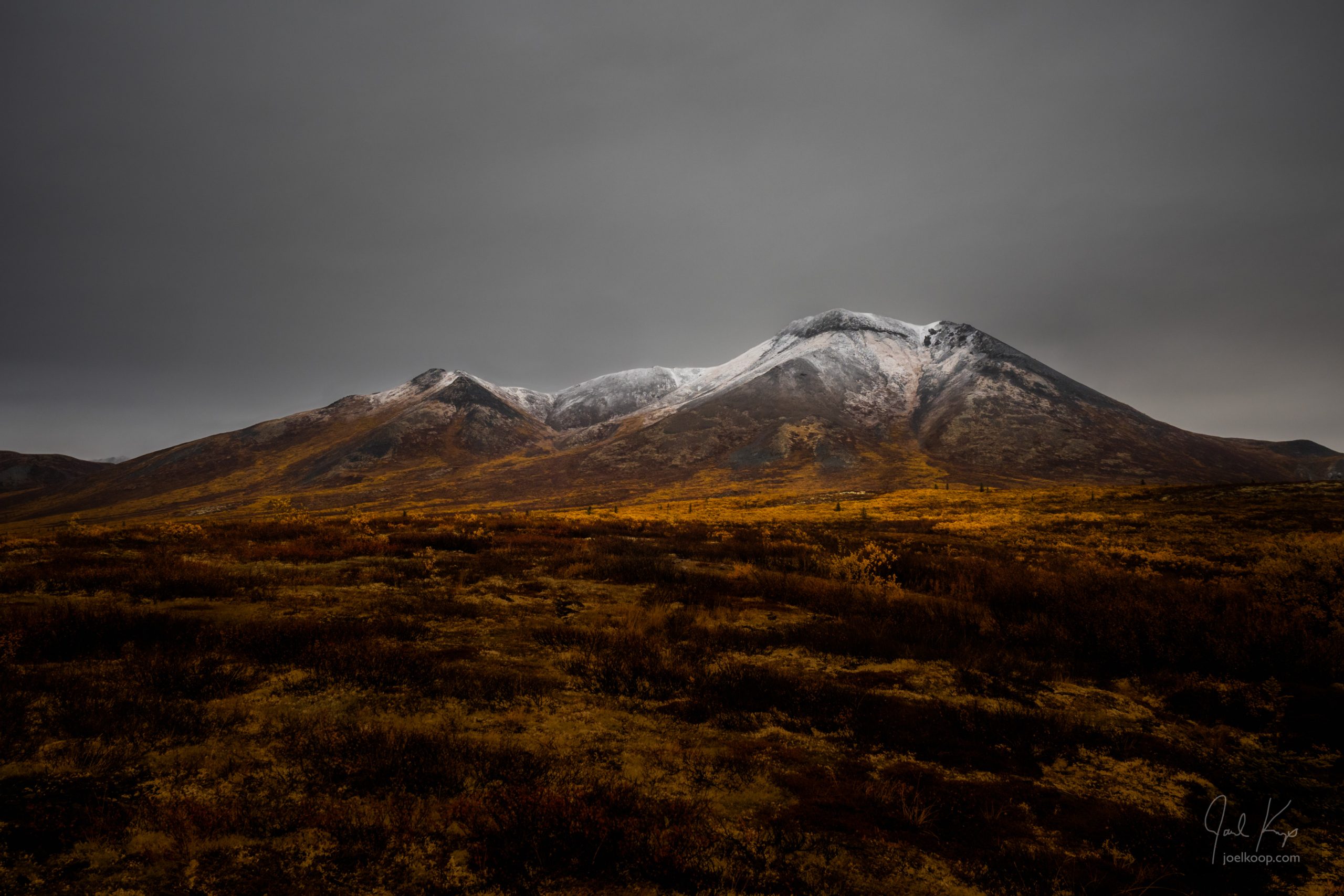
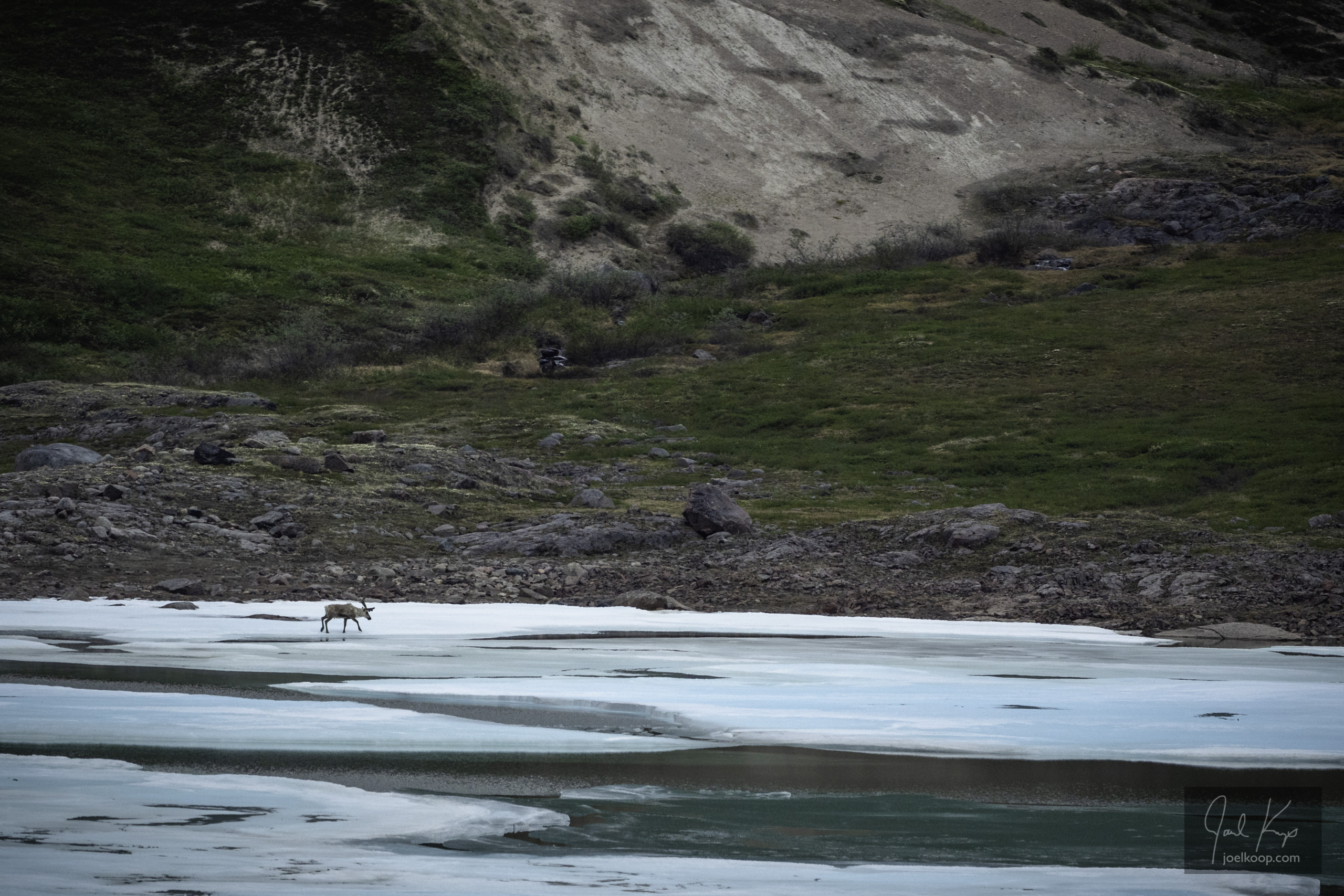
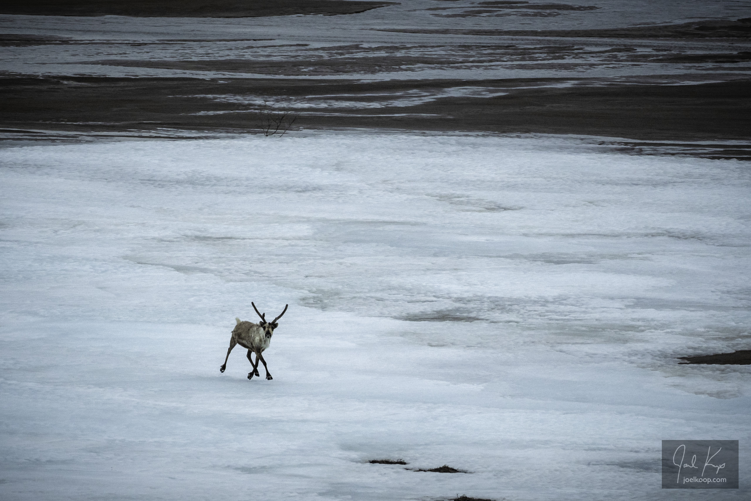
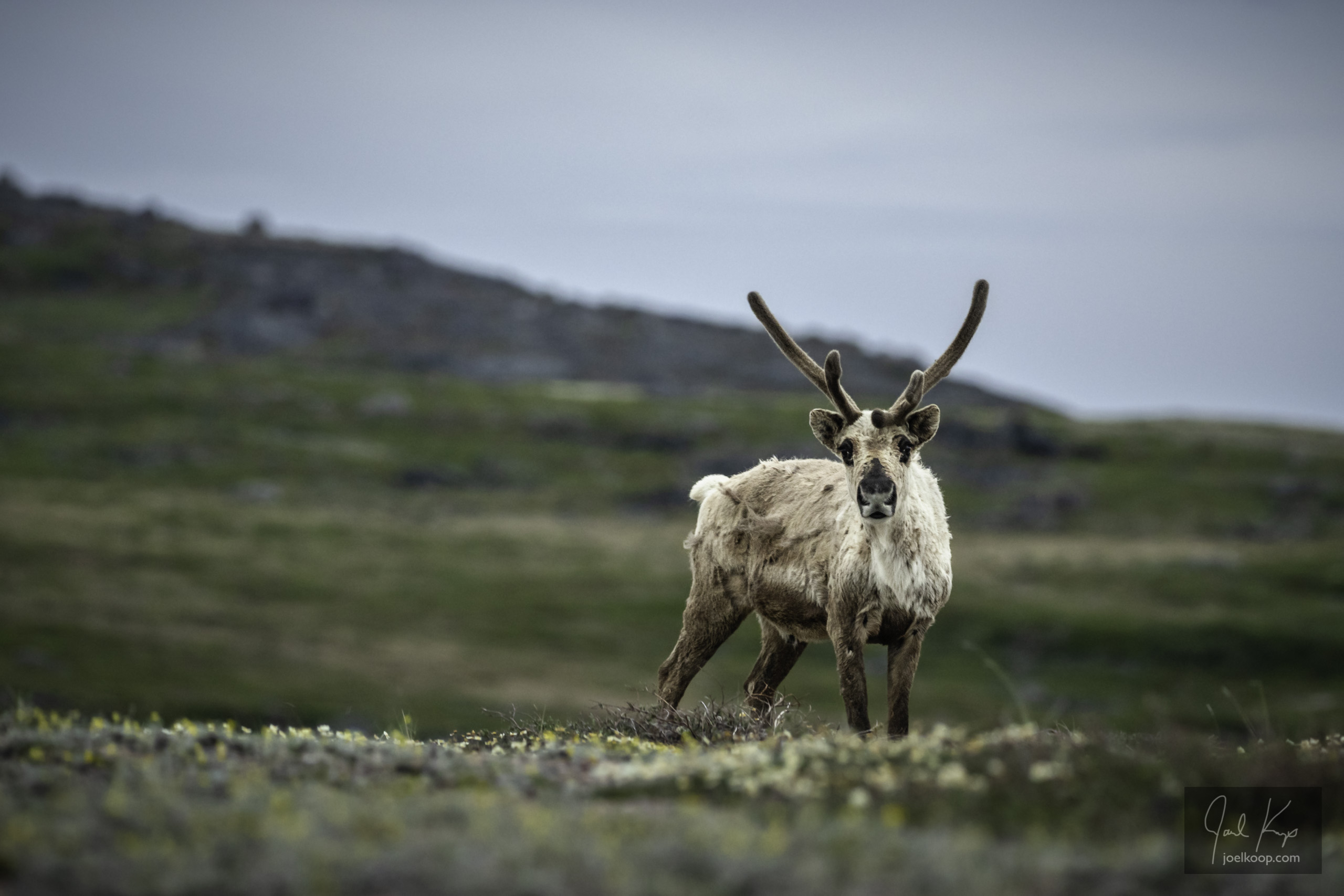
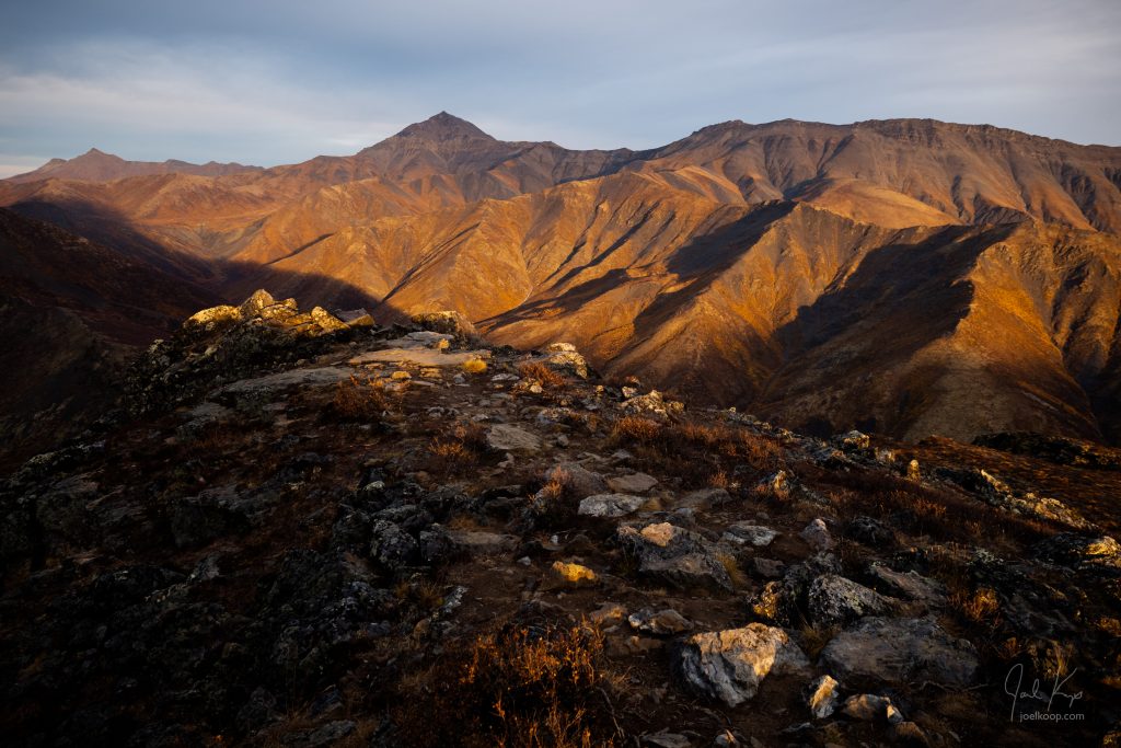
Looking towards the grey Ogilvie Mountains from the north end of the park.

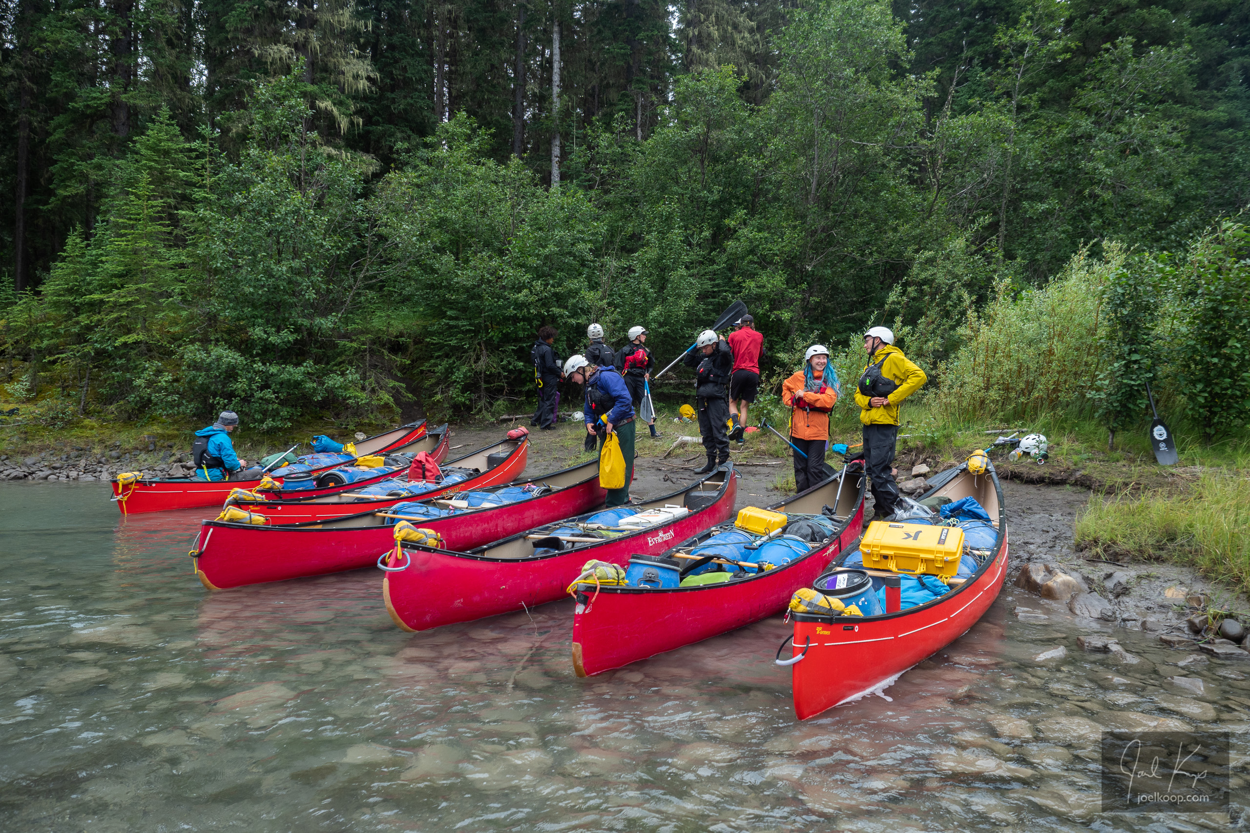
If you are planning to travel here and you want any specific advice, feel free to comment or email me. I enjoy talking about trips and places, although I’m often away and I might be slow to respond. The Dempster “Highway” is a rough gravel road that has been known to cause flats (we survived with no casualties – until later in our trip). The gas stations are few and far between. There is no cell access anywhere. You can not get extra supplies if you forget them. You should be prepared for any emergencies. Now that all those warnings are out of the way, it’s not that bad. Don’t be scared to do it. There are usually other travelers around, and most are friendly and helpful should you need it.

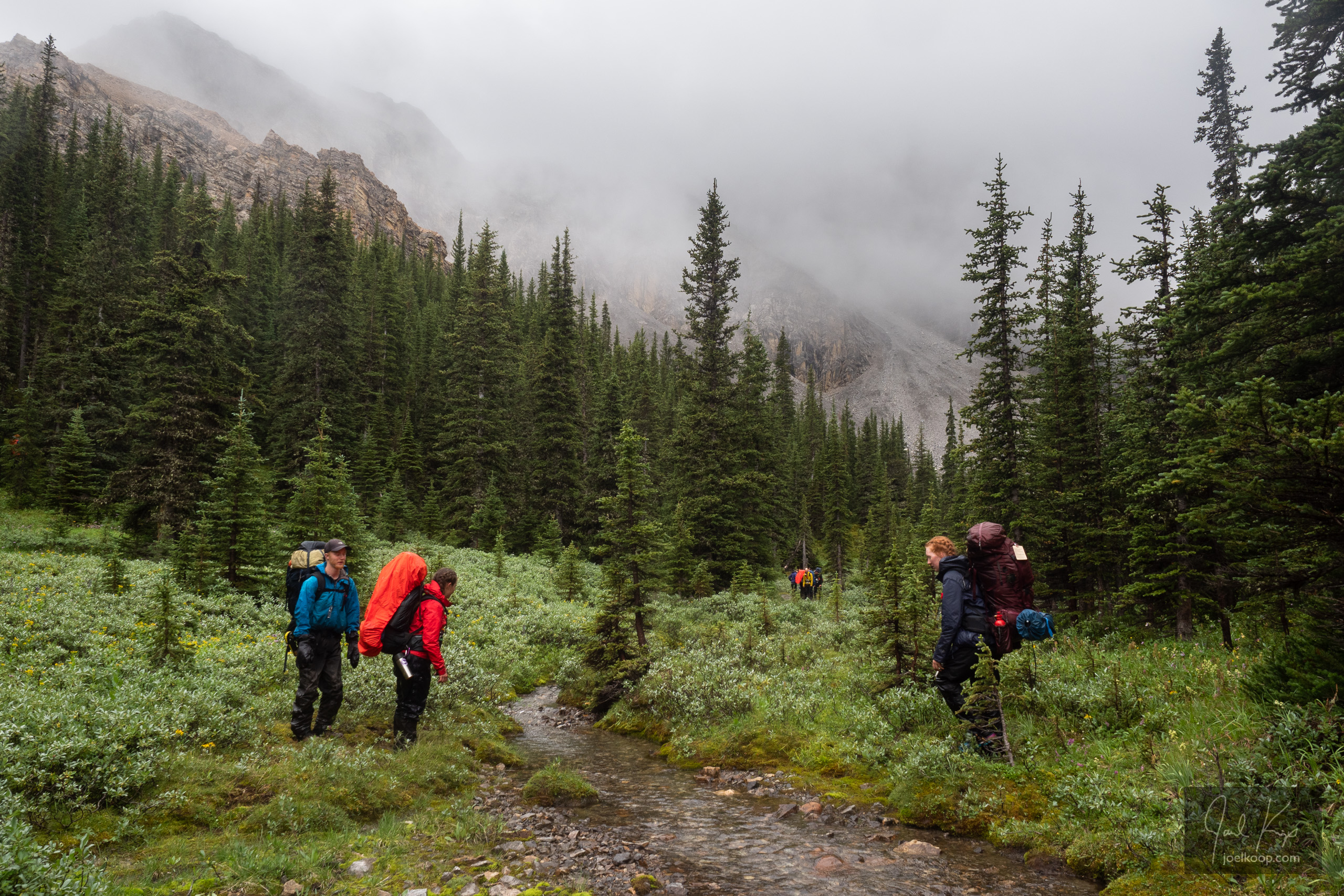
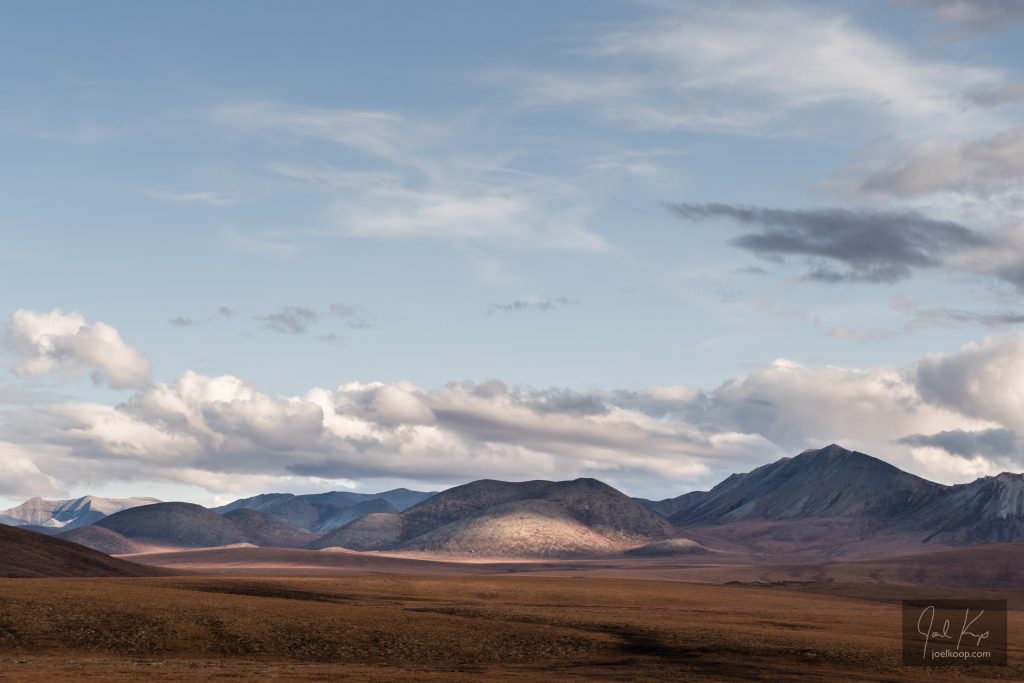
The streams are mostly surrounded by tall willows. There are lots of spruce trees near the south end of the park, but very few in the north – even the willows get a bit smaller.

The leathery colors of fall blending into the monochrome of the coming winter.

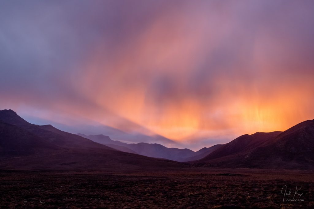
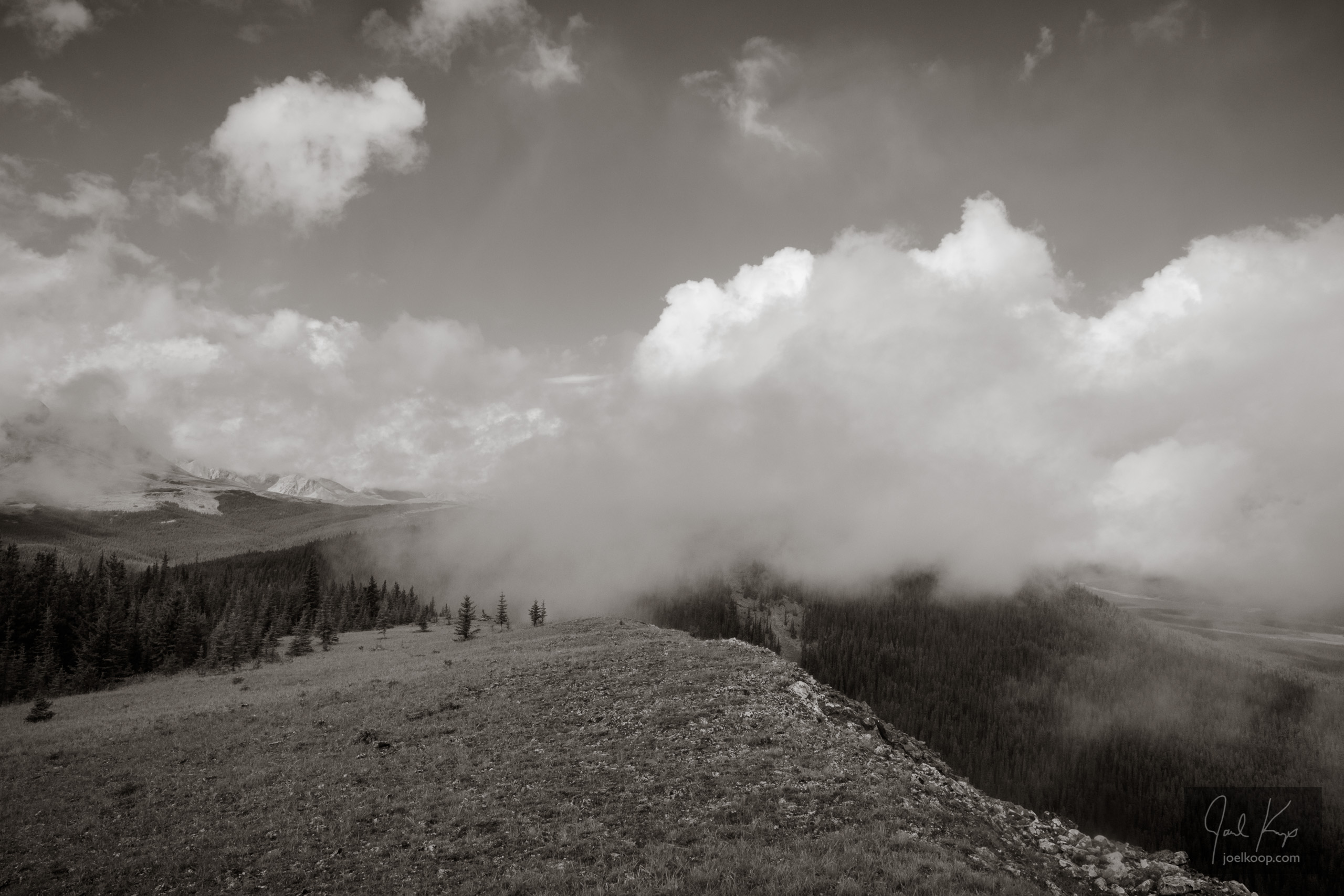
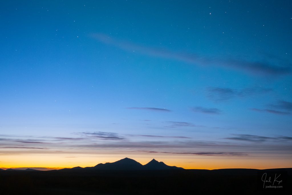
Bad weather is the best weather.

A Break in the Badlands

Our tent on the banks of the Red Deer River.

After a full spring of leading canoe trips, photography, and classes, I got to take a break with Anna. We headed out to the Red Deer River and had the most relaxing canoe trip of our lives. We took three days to do a stretch of river that could have been done in one long day. To fill the days we wandered in and out of the badlands, mooed at the cows we drifted by, and tested out the packraft I built this past winter (found two slow leaks that I think I have patched now). Next week I’m off guiding again which will fill up most of the rest of the summer.

Just a quick note about prints: I know some of you have been looking for more northern lights prints. Tix on the Square sold out a while ago but they will have a new supply in a couple days!

Grizzlies on the Hood

Grizzlies grazing on the banks of the Hood River.

Below the Wright River confluence the character of the Hood River changed. It started feeling like a legitimate river with a significant current. It started to get a bit splashy, so we put the spraydecks on the canoes. This let us keep paddling instead of constantly bailing water out of the boats. It turned out that our packboats were all leaking a bit, so we occasionally had to stop and bail anyway. At one point we spotted a couple grizzlies grazing on the bank. We watched them for about 15 minutes before they spotted us. The younger, lighter colored bear took off along the shore, swam across the ice-cold river, and disappeared over the north bank. The mother (we think) followed shortly after, keeping a close eye on us.

We started paddling with spraydecks, as there were frequent small rapids.

Skull Rapid

Having lunch above Skull Rapids on the Hood River

Skull Rapid – it’s an ominous name for a long and violent rapid, crashing over and through large boulders. This was our first portage of many, right at the outlet of Esker Lake. We figured out how to organize our gear, how to tie loose gear on to packframes, and how much we could all carry. It was a short portage at only a few hundred meters, and we completed it fairly quickly and had lunch on the bluff overlooking the rapid. The rapid is named for an old muskox skull, slowly decaying in the mats of flowering labrador tea (Ledum sp.).


Last Caribou in the Hood?

If we’d done this trip twenty years ago there’s a good chance we’d have canoed through herds of thousands of caribou. The north is peppered with stories of watching thousands of caribou stream past for hours, but not recently (at least in this part of the arctic). The Hood River is in the Bathurst Caribou range – it actually flows right through the traditional calving grounds, although those may be changing a bit too. We were hoping to see caribou on this trip, but we knew the chances of seeing a large herd was small. In 1986 the Bathurst herd was around 500,000 caribou, in 2015 it was 20,000 and today it is 8,200 (source).

In late June we pulled our canoes over the last bit of ice on Esker Lake. We got to the end of Esker Lake and camped on a large point of sand covered with Mountain Aven (white flowers with a yellow center). Although it was a lot of work hauling our gear up the sandy bank, the camping spot was spectacular. After camp was set up, supper cooked and everyone fed, most people headed to bed. I was tired, but I couldn’t pass up a short hike. As I walked up the sandy ridge (I don’t actually think it was an esker – it was too large of a sandy area) I admired the large ice-covered delta where a small river flowed out into a bay on the lake. I got to a high point and sat down to appreciate the view. Then I spotted something moving.

There was a lone caribou picking its way over the ice of the delta. I watched for a while – it was slowly getting closer to our camp. I’d heard about someone holding up their arms too look like caribou horns so caribou wouldn’t be scared of them and I thought I’d try it even though the caribou was still at least 500m away. I stood up and put my arms up. I saw it turn its head towards me and pause. And then it started running – towards me!

I was surprised, but I kept my hands up as much as I could while still snapping a couple pictures. The caribou ran across the delta, right in between the tents in our camp and up the ridge towards me. It got really close and I couldn’t resist – I dropped my arms to take some photos. And the caribou stopped. I’d lost my antlers and now it didn’t know what to make of me. It studied me for a minute, tilted its head this way and that, and eventually decided that I wasn’t a caribou. I may be anthropomorphizing, but that was the saddest caribou I could imagine trotting away from me. It went over a rise and disappeared.

I felt so sorry for that lonely guy. He looked so hopeful for a friend and I’d let him down.

Canoeing on Ice

Ice on Cave Lake

Ice on Cave Lake beside our first campsite.

To canoe in the arctic you either have to wait until late in the summer or encounter ice at some point. There was still plenty of ice on the lakes when we started on the Hood River in late June.

On Cave Lake, we started by trying to skirt the shore where the ice was mostly melted. We quickly ran into solid ice right up to the shore. The ice was still thick enough to support us in most spots. With the normal canoes, you could take a run at the ice and if you had enough speed, the front of the canoe would pop out of the water and you’d launch yourself onto the ice. Then the bow paddler could quickly jump out and pull the canoe all the way up.

With pakboats it was a little more tricky. You would have to sidle up to the ice and try to step out onto a relatively slippery surface without pushing your boat away from the ice. And since the bottoms of the pakboats are a sticky rubber material, we had “crazy carpets” that we would tie to the bottom of the boats so they would slide easily on the ice, similar to the regular canoes.

Then we would pull the loaded canoes across the ice, sometimes for quite a few kilometers at a time. Occasionally there would be breaks in the ice where we would have to get in the canoes, paddle for a meter or two, and get back out and pull further.

The trick for not falling through the ice is to stick to the whiter areas. The darker spots are where the ice is starting to melt and get soft. Usually it was still pretty thick there, but the lighter colored ice was definitely more solid.

No one fell through the entire trip!

Ice on Esker Lake

Pulling canoes over Esker Lake a few days later.

Ice on Cave Lake

Ice piled up on the shore of Cave Lake. You can see a little band of water we had to canoe over in the distance.

Mixing ice and water

The trickiest parts were where water and ice mixed.